ArboursAbroad contains affiliate links. As an Amazon Associate, we earn from qualifying purchases. If you purchase using one of the affiliated links, we may receive compensation at no extra cost to you. See our Disclosure Policy for more information.
In our opinion, the best sunset hikes Sedona style are those without the crowds of people and ones where you get a bit of the actual sunset mixed with the beautiful changing colors of the red rocks.
Sunset hikes in Sedona bring hiking in Sedona to the next level. Watching the colors change on the red rocks around you, and if you’re lucky seeing the clouds in the sky being painted all shades of orange and pink, bring on the feelings of gratefulness Sedona is known to carry.
We did a lot of sunset hikes in our three weeks in Sedona. Actually, we did a lot of just hiking in general… Somehow Sedona made us avid hikers!
Anyways, that’s beside the point.
Each hike we did in Sedona, we were sure to pay attention to if it would be a good sunset hike or not. How would the red rocks be illuminated, if illuminated at all? And, could we see the sun actually setting while on the hike?
You can see a full list of our 31 Sedona sunset locations here. There are a handful of sunsets in Sedona that don’t require hiking, and you’ll find them in that post. This post is all about the best sunset hikes Sedona style!
A Couple Notes On These Best Sunset Hikes Sedona
- To be considered a hike for us, the trail had to be at least half a mile long. There are some other great sunset locations in Sedona that don’t require hiking at all, you can see them in our list of best sunsets in Sedona.
- You will not find Red Rock Crossing in this post. That is a far cry from the best sunsets in Sedona! However, you can find Red Rock Crossing and 31 other Sedona sunsets here.
- Always give yourself more time than you think for these hikes. The sun will set before actual sunset time in Sedona, as the sun dips behind mountains in the west, so to see the sun, you’ll need to get to each place earlier than said sunset time.
Parking Tips for Sunset Hikes in Sedona
- Red Rock Pass | For each of the $5 parking fees listed below, you can use a Red Rock Pass. The Red Rock Parking Pass gives you access to parking for an entire day. You can also purchase a week long pass if you’re in Sedona for longer than a day. The passes can be purchased at each parking lot.
- National Parks Pass | Alternatively, instead of paying for a Red Rock Pass, purchase or bring along your America The Beautiful Interagency Pass. This is the $80 national parks pass for the United States, and it’s good for an entire year of free access to all the national parks, monuments, and national forest fee areas! It’s a fantastic deal and will save you loads if you plan on visiting any of the United States National Parks.
- Free Parking | As a third option for parking, most of the paid parking lots have free parking on the road. This is an acceptable way to park unless it’s otherwise noted. Just try and stay as much on the road and dirt as possible, without ruining the fragile plants in the area.

7 BEST Sunset Hikes Sedona
Sedona View Trail Benches | Easiest Sedona Sunset Hike
Location | 34.85413, -111.78777
Parking | Free Airport Loop Parking Lot | 34.85565, -111.78021
Duration | .8 miles round trip
Elevation | incline entire .4 miles there, then decline on the return
Terrain | rocky, and super muddy after heavy rain or snow
At Airport Mesa, there is a super famous “sunset” spot called the Sedona Airport Scenic Lookout. Honestly, I don’t know why that spot is so famous for sunsets in Sedona, as the views kinda suck!
The reason I mention it is because we found these benches on the Sedona View Trail on our way to the Sedona Airport Scenic Lookout. And unfortunately, we passed right on by them to see what all the hype was about at the lookout.
On our return back down the Sedona View Trail to the parking lot, we paid more attention to the viewpoint from these benches, and we were so pleasantly surprised, and also slightly bummed we didn’t enjoy the sunset from them!
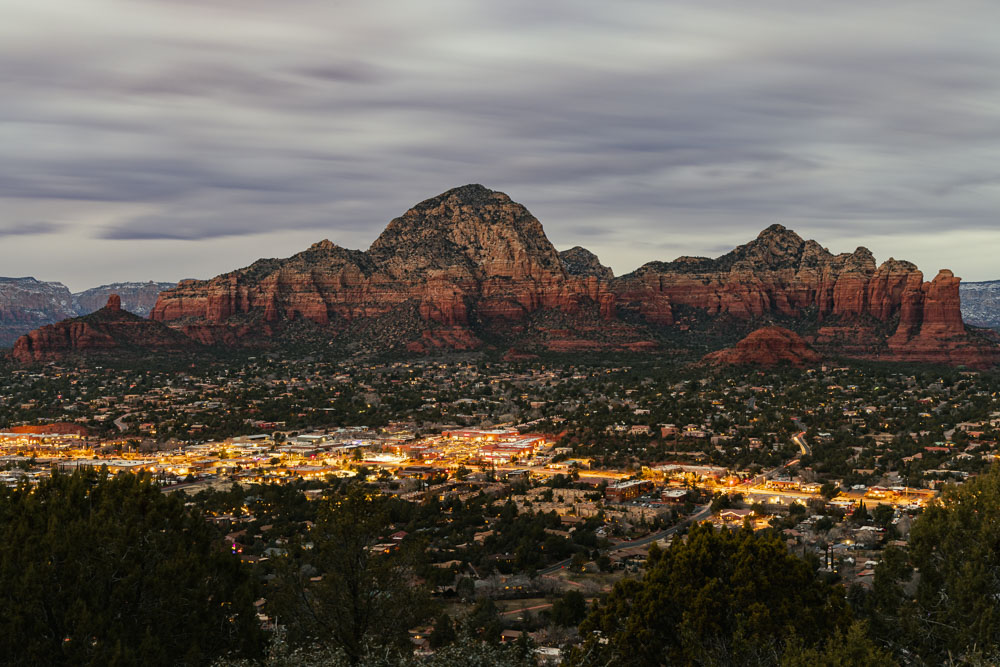
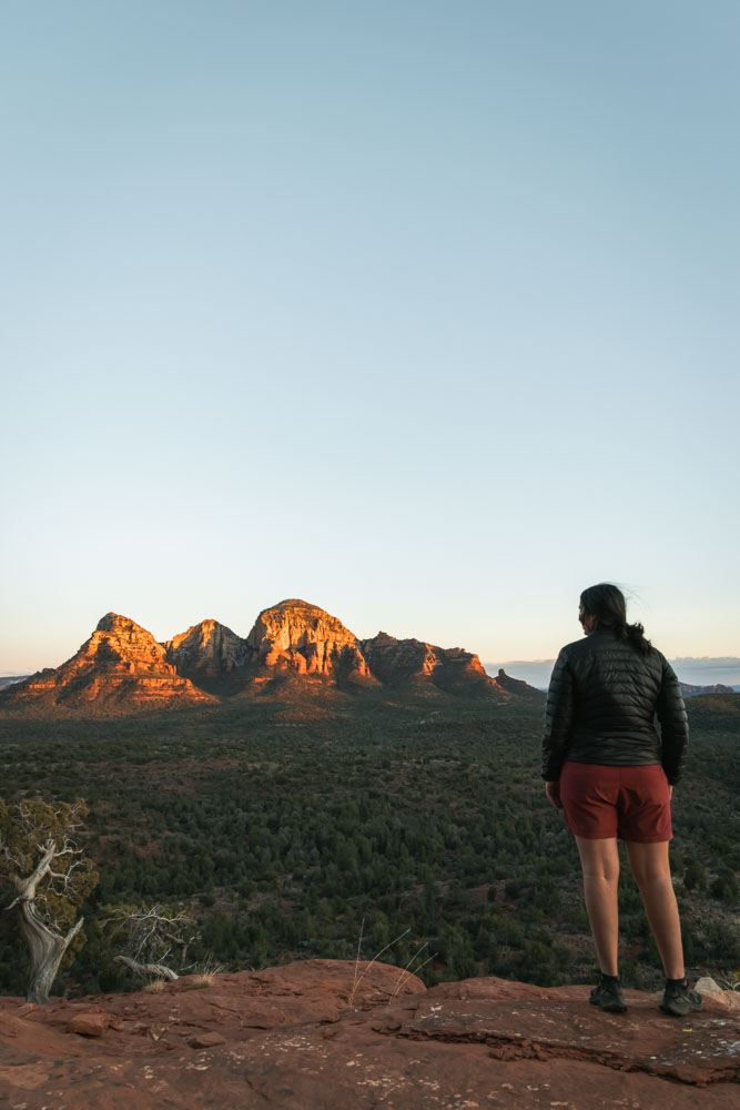
These benches overlook Sedona west with Thunder Mountain, the big red rock formations as the backdrop to Sedona. There are no trees or fences in the way, and the best part is there aren’t hundreds of other people!
It’s the perfect sunset hike in Sedona to pack a blanket, chocolate, and some wine and enjoy the sun going down.. especially since it’s such a short sunset hike!

Hiking From The Free Airport Loop Trailhead Parking
First things first. There are two parking lots that offer super close parking to these benches. The free airport loop parking lot (coordinates above), is the closest free lot. However, that also means you’ll be hiking uphill to the benches.
Since this is the closest free parking lot, and it’s also right at the base of Airport Mesa Vortex, this parking lot fills up quickly! Particularly around sunset time. With only 10 spots in the lot, it’s easy to understand why!
We suggest arriving extra early to secure a spot here, and then maybe just checking out the Airport Mesa Vortex to kill time until sunset.
From the parking lot, go up the red rock steps near the big trail sign. Going left will lead you to the summit of the Airport Mesa Vortex. Staying to the right side, along the fence, you’ll bump right into Sedona View Trail.
This trail says it’s .6 miles, and it is up to the other parking lot, but it’s .4 to the benches. The trail is uphill the entire way, and is extremely muddy after a lot of rain in the winter!
Enjoy the views of Sedona on the way to the benches. And if the first bench is taken, there is one more further up. Alternatively, you may have to just hang on the rocks if the benches are both occupied
From the $3 Airport Parking Area
If you don’t want to hike as far, or if the free lot is full, the $3 parking lot at the top of the hill offers parking just a short flat walk to the benches. This parking lot is much bigger, and will likely definitely have space for you to park.
From here, the trail to the benches parallels the road. Look for a trailhead with big signs saying Sedona View Trail near the porta potties. You’ll have a short walk to a gate… go through the gate, making sure to keep it closed behind you, and then continue about another 50 yards until you see the first bench.
Altar Cave | The BEST Sunset Hike Sedona
Location | 34.905894, -111.840728
Parking | $5 at Boynton Canyon Trailhead | 34.907356, -111.848582
Duration | 2.63 miles
Elevation | 839 feet
Terrain | on well-maintained trail until the red rock scramble at the end
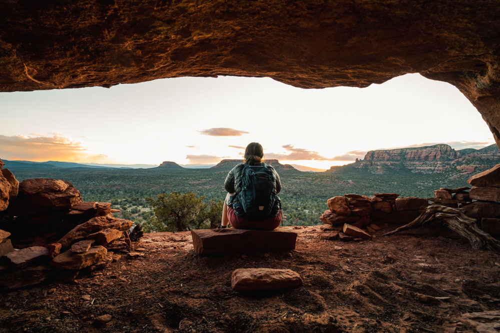
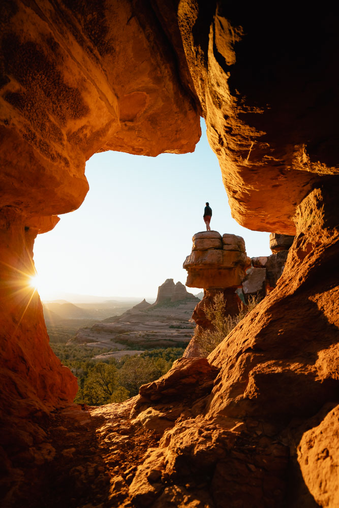
Oh my goodness.. This may just be one of my favorite hikes in Sedona. It’s short, but the views are incredible, and there are not one, but FIVE CAVES on this one hike!
We went to Altar Cave after reading it was good for sunset, and along the way were just shocked at how many more caves are right in the same area. And shoot.. while the views from the actual cave were incredible, the views from the flat slick rock above Mescal Trail were great too.
READ MORE | Your Guide to 5 Caves Along Mescal Trail
Hiking to Altar Cave was one of the last things we did in Sedona, and when we got to the cave for sunset, we knew we would be updating this post to include the cave in the best sunsets in Sedona locations!
Hiking to Altar Cave
To get to Altar Cave, you need to park at the Boynton Canyon Trailhead lot. This parking lot costs $5, and is typically full during the day, but was nearly empty when we got there for this sunset hike.
If you don’t want to pay for parking or don’t have your National Parks Pass, you can park along the road just past the stop sign junction.
From the parking lot, take Boynton Canyon Trail until it T’s. At the t, go to the right. If you go to the left, you go into the canyon, this is not where you want to go!
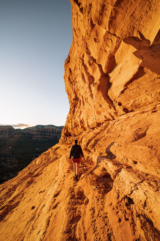
Heading right, you’ll be on Deadman’s Pass Trail. Stay on this trail, until you see Mescal Trail peeling off to the right. The coordinates for this junction are, 34.911102, -111.843639.
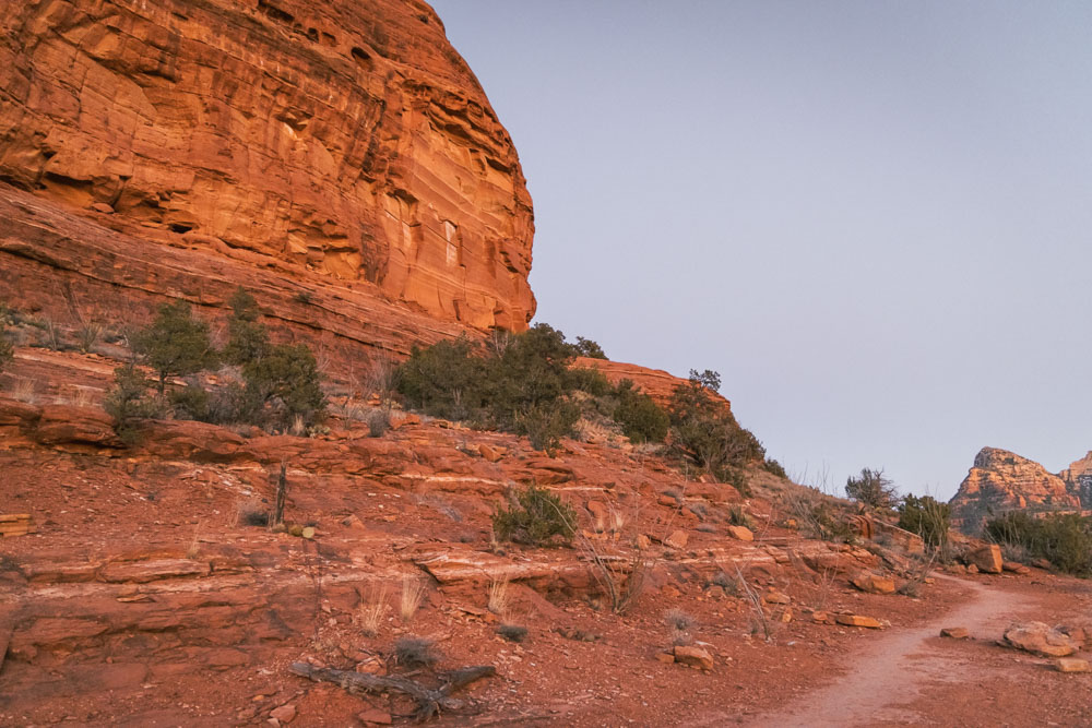
Hike along Mescal’s Trail until you see massive boulders are both sides of the trail. (pictured above) This is where the trail takes a sharp turn to the left, and if you start going left, you’ve gone too far.
At the boulders, peel off of Mescal’s Trail and start your scramble up the wash of the red rock. There is a little climbing involved, but nothing too difficult or scary!
Once you reach the top of the red rock shelf, Altar Cave is to the left along the red rock wall. You’ll see a couple of caves in the area, and to the right are great sunset views too!
Secret Viewpoint in Boynton Canyon | Trailblazing Sunset Hike Sedona
Location | 34.9194782, -111.859645
Parking | $5 at Boynton Canyon Trailhead | 34.907356, -111.848582
Duration | 4.5 miles round trip
Elevation | roughly 600 feet
Terrain | flat at the start, then rock scramble and trailblazing up a dry creek crevice between red rock

This hike is part of a longer loop that we seriously recommend in Boynton Canyon. The views all the way around the trail are fantastic and they make for a really cool full day of hiking in Sedona!
READ MORE | Hiking the Incredible Boynton Canyon Sedona Loop
DO NOT DO THIS HIKE IF YOU AREN’T FAMILIAR WITH HIKING / TRAILBLAZING
To get to just this viewpoint, which would be fantastic for sunset, you hike on Boynton Canyon trail for 1.3 miles, then turn off to the left and hike/climb up a dry creek.
The turn-off of the Boynton Canyon trail is not marked, but here are the coordinates for it… 34.92065, -111.855882. From there you hike up the wash.
Please DO NOT do this if you are not comfortable hiking and trailblazing / finding your own way!


You’ll then jump out of the creek, do some rock scrambling on some red rock, and then begin a rock climbing experience up the rest of the creek. While the rock climbing isn’t technical, it’s definitely not for those with bad knees or unfamiliar with this kind of terrain.
READ MORE | The BEST Shoes for Hiking in Sedona
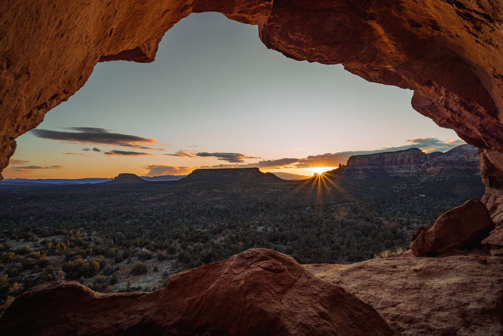
There is a short side peel off that leads to a secret Boynton Canyon Cave and cliff dwellings. This is the famous secret cave with the tree inside, Kachina Tree.
Walking through the cave and around the ledge to the cliff dwellings, you’ll find epic views for sunset.
Alternatively, after seeing the cave and cliff dwellings, you again hike up the dry creek crevice until you end up on top of the red rock cliff! You’ll know you’re there when the “trail” opens up and you have gorgeous views all around instead of rocks right in your face!
It is trailblazing to the top..
Do not do this hike if you are not comfortable in nature and can find your way without a true proper trail in front of you.

Merry Go Round Rock Cave | Hardest Sedona Sunset Hike
Location | 34.873969, -111.708453
Parking | $5 at Huckaby Trailhead | 34.866512, -111.74869
Duration | 7.8 miles out and back
Elevation | 1,079 feet
Terrain | multiple creek crossing, muddy and icy in winter


Merry Go Round Rock is a trek to get to, but the views and photo opportunities are well worth it. The rock itself isn’t what’s to freaking die for.. it’s the cave photo at sunset that’s absolutely amazing.
The views from Merry Go Round Rock and the trail all the way there and back are stunning. Now, the trail itself (Munds Wagon Trail) parallels a road that’s accessible for 4×4 high-clearance vehicles. However, the road was closed when we were there in February due to snow and ice.
If the road is open, and you have a high clearance vehicle, there really isn’t much hiking involved. And, even more, if you have a mountain bike, we’d actually suggest riding up to Merry Go Round Rock instead of hiking, because it’s 4 miles uphill one way!
All that to say, again, the views are incredible, and this may end up being a top hike if you can push through the length of the trail!

Hiking to Merry Go Round Rock Cave
Reaching Merry Go Round Rock hiking, you’ll take the Munds Wagon Trail from Huckaby Trailhead. This trail is 4 miles long one way, and ends at Merry Go Round Rock.
While we didn’t take the trail, because we rode, we could see the trail often. The trail follows the creek, with some pretty swimming holes, and crosses back and forth over both the creek and the road as it climbs the mountain.
Don’t underestimate the elevation gain and length of the trail when taking this trek on!
Coming up Munds Wagon Trail, Merry Go Rock Rock will be on the left side of the trail at the top. When you get to the following coordinates, 34.874295, -111.706872, you’ll know you’ve reached the cave!
The cave is actually below the ledge of the trail, and is to the right, right along the cliff. It’s a pretty well traveled path with a lot of downed trees to reach the cave and viewpoint.
Again, if you have a 4×4 high clearance vehicle, you can shorten the length of this hike, by driving to Merry Go Round Rock.
Cathedral Rock Saddle | Busiest Sunset Sedona Hike
Location | 34.818815, -111.792184
Parking | $5 on Back O Beyond Trailhead Only Open Monday – Wednesday | 34.825141, -111.788297
Duration | 2.39 miles
Elevation | 1,259 feet
Terrain | scrambling up red rock with rock climbing sections


First off, I’m hesitant to include this as a sunset place in this post, because with the new shuttle system in place, I think it’s much more difficult to hike Cathedral Rock at Sunset.
Thursday – Sunday there is a Sedona Shuttle that operates during the day, and the road to Cathedral Rock Trail is blocked off with a guard to anyone that doesn’t live on the road. Talk about frustrating!
Check current shuttle times here. And know that if you visit Sedona Monday – Wednesday, you don’t have to deal with the dumb shuttle times.
Anywho.. Cathedral Rock is brilliant at sunset! You don’t really have a direct view of the sun setting or even of rock formations changing colors, but the view is stunning!
Cathedral Rock may just be the best sunset hike in Sedona of all time for its uniqueness. With that said, it’s really not a hike but more of a complete and total rock scramble all the way from the parking area of Cathedral Rock to the Cathedral Rock Saddle.

Hiking Cathedral Rock from Back O Beyond Trailhead
First, pay your $5 parking fee or set out your national park pass. Then be sure you have a camelback of water and a headlamp for your scramble back down.
Jumping on the trail, it starts off as a well-maintained path with railings on both sides to make sure you stay on the trail. Once you hit the red rock, it’s a completely different story!
On the red rock, just follow the cairns in the general direction of up. It’s a straight rock scramble the entire way, with some sections where rock climbing experience would be helpful!
You should definitely be wearing grippy trail shoes, here’s what we recommend, and be in decent shape. It’s a fun rock scramble to the top, but it’s unrelenting in being uphill and over 1,000 feet of elevation gain in just one mile!
Reaching the Cathedral Rock Saddle, you’ll see a sign that says end of trail. It’s also very obvious, as the view opens up and there’s a large flat area to sit and soak the views in from.
Be sure to hike up to the second saddle/the spire area of Cathedral Rock. To do so, go left at the “end of trail sign”, but then stick to the right side of the red rock. You’ll go around the red rock, then have one more climb straight up to the second saddle.


Bear Mountain Secret Side | Secret Sedona Sunset Hike
Location | 34.900015, -111.867487
Parking | $5 at Bear Mountain Trailhead | 34.893448, -111.865196
Duration | 2 miles round trip
Elevation | 400 feet, all in one spot with stairs for part of it
Terrain | well-maintained trail with steep red rock steps

Hiking to The Secret Side of Bear Mountain
Starting at the Bear Mountain Trailhead parking, you cross the road, and directly opposite of the parking area, you’ll see a gate. Walking through this gate, you’ll follow this super-defined trail all the way up to the second shelf of the red rock cliff.
Do not go up the trail in the actual parking lot. This trail is up Doe Mountain, and while it’s nice for sunset there, this secret spot is better!
This is a rather strenuous climb. It’s short, yet super steep. Think basically just going up stairs for about 30 minutes. Thankfully, the views on this part of the hike are great too, and if you’re feeling too tired you can just stop and watch the sunset anywhere along this trail.
If you’re not too tired, continue up the mountain! You’ll pass one little “shelf”, a flat area on the trail, before going uphill yet again.
This time, not for as long of a distance. Once you reach the next flat area, (aka the second shelf) there is a “social trail” to the right, right near the ledge.


A social trail is basically just a trail that’s not as widely used, and one the locals are trying to keep a secret. We say screw that, and as long as you respect the land, it’s public land, and you have the right to enjoy the views from there too… even if you don’t live in the area!
Follow this trail until you find a place you’d like to sit and enjoy the sunset. Remember, however far you go out, you have to return back!
While we have an entire post on the entire hike, to the cliff dwellings, cave, and epic viewpoint (coming soon), if you’re only hiking this for a sunset hike in Sedona, you simply need the following coordinates for where to turn off of the main trail, 34.899252, -111.868959.
If you download the free app, maps.me, then download the Sedona region, you’ll see the trail is actually a marked trail on that app! Once you have the region downloaded, you can access the maps offline. It’s a great way to make sure you’re going the correct way!
After sunset, head back the same way you came. And enjoy the peaceful views and easy hike back down!
READ MORE | maps.me A Free Offline App You Should Get
Devils Bridge | Busiest Sunset Hike Sedona
Location | 34.897663, -111.807711
Parking | Free at Mescal’s Trailhead on Road | 34.901805, -111.826766
Duration | 4.35 round trip via Chuckwagon Trail at Mescal Trailhead
Elevation | 588 feet, mostly at end of the trail
Terrain | red dirt trail, with red rock climbing at the end


Hear us out on this one. When hiking Devils Bridge in Sedona for sunset, you actually want to be leaving the bridge just before sunset. We hiked Devils Bridge just before sunset in January, and with the location of the bridge and the surrounding red rock, there is no way the bridge itself would be nice for sunset.
It sits hidden behind a much larger red rock formation, making it totally in the shadow before sunset. And the contrast of rocks in the shadows and the direction you shoot at Devils Bridge makes being at the bridge just a major sunset fail.
However, hiking back from Devils Bridge right at sunset is literally perfect! Coming off the cliff that Devils Bridge is on, you’ll have some freaking epic red rock views. Continuing down from Devil’s Bridge trail to Chuckwagon Trail back to Mescal Trailhead, you’ll be greeted with 360 degree views of the Sedona sunset.
It’s remarkable. We just kept stopping and turning around looking in all directions as the colors changed while the sun went down. Honestly, hiking back down from Devils Bridge at sunset is what made this one of the best sunset hikes in Sedona for us!

Hiking to Devils Bridge
We recommend hiking Devil’s Bridge via Mescal Trailhead because the views are just super incredible. And unlike hiking from Dry Creek Road, you won’t be hiking with all the 4×4 vehicles!
Starting from the Mescal Trailhead, park in the lot on the road, and then from that lot there is a very obvious trailhead with signs and a map.
From there, you’ll follow the trail to a creek crossing. We hiked Devils Bridge in the winter, and were extremely thankful for our waterproof shoes, as the water was high and other people had wet feet here.
Crossing the creek, follow Chuckwagon Trail all the way until it reaches the OHV road. It’s almost exactly one mile, and has gorgeous views the entire way.
Crossing the road, you’ll be right at Devils Bridge Trailhead. Take this trail all the way up the mountain, up the red rock steps, and to Devils Bridge.
The best view for sunset is after the first climb of stairs on the red rock. The second-best sunset views are along Chuckwagon Trail. And if you don’t want to hike all the way to Devils Bridge, you can enjoy the sunset along that trail instead.


Best Sunset Hikes Sedona | Honorable Mentions
Airport Mesa Vortex
Location | 34.85575, -111.77913
Parking | Free Airport Loop Parking Lot | 34.85565, -111.78021
Duration | .4 miles round trip
Elevation | short climb to the top of vortex
Terrain | red rock steps with railing

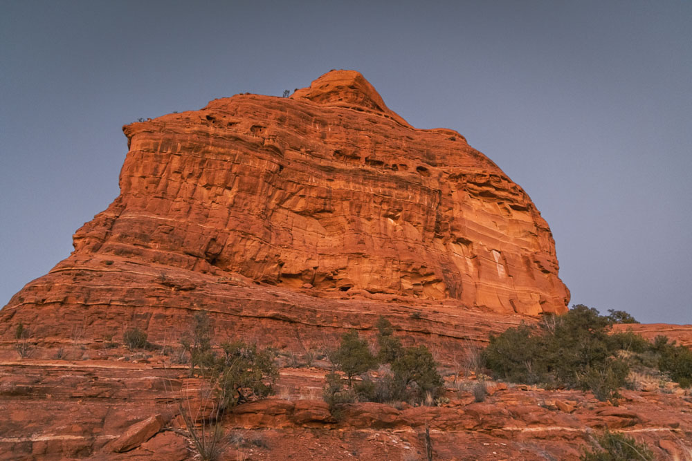
The Airport Mesa Vortex is a great place to watch the sunset, or rather the rocks changing colors from the sun setting.
The actual sunset from the vortex will be behind the airport mesa, so you won’t see the sun dip below the horizon from here. However, you’ll get to see the red rock change colors on both the southern part of Sedona (the Village of Oak Creek side) and the northern bit (or Sedona West).
Seeing how different the sunset can be on both sides of Sedona really puts in into perspective how huge the mesa and surrounding rocks are. You’ll get a glimpse of the iconic Sedona landmark of Courthouse Butte, and even be able to see Bell Rock from here too.
Parking at the Airport Mesa Vortex is super limited, as it’s also the trailhead for the Airport Mesa trail, so we recommend getting here early if you wish to park right at the base.


Hiking Airport Mesa Vortex
To get to the top of the Vortex, the trail is called “Summit Trail“. From the parking lot you go up the red rocks, then immediately swing a left.
You’ll walk on some flat red rocks for just a handful of steps before the trail is marked “summit trail” and follows a cable fence up to the top of the red rock. This is the Airport Mesa Vortex.
LEARN MORE | What Is A Vortex + What To Know Before Visiting Airport Mesa Vortex
Sugarloaf Mountain
Location | 34.876326, -111.794149
Parking | Free at Sugarloaf Trailhead | 34.87429, -111.796447
Duration | 1.52 miles
Elevation | 338 feet
Terrain | mixture of sand and red rock

In the interest of full disclosure here.. we hiked Sugarloaf Mountain for sunrise in Sedona, not sunset. However, with the 360-degree views and just kinda paying attention to lighting and such throughout our three weeks in Sedona, we know this would be a fantastic sunset hike in Sedona!
If we had time, we would have hands down returned to Sugarloaf Mountain for sunset, but we just never found ourselves in that area again during that time.
It’s worth noting, the parking area at Sugarloaf Mountain is quite small. So if you plan on doing this hike for sunset, be sure to get there early to secure a parking space. There isn’t alternative parking in the area.
READ MORE | Our Complete Trail Guide to Sugarloaf Summit


Hiking Sugarloaf Mountain for Sunset
From the parking lot, the trail to the Sugarloaf summit is pretty well marked. And it’s a more popular trail in the area, so it’s wide and easy to follow.
The hike starts off relatively flat along a mixture of red rock and sand, before peeling off for the “Sugarloaf summit” area, where it will be uphill to the peak of Sugarloaf. In this small section, you’ll be doing nearly all of the elevation gain for this hike.
To be honest, the hike was actually quite a bit steeper than both of us were expecting, but the 360 degree views make it well worth it!
TRAIL GUIDE | Hiking Sugarloaf Mountain for Sunrise
SEDONA CAVE | Keyhole Cave Guide | if you’re hiking Sugarloaf, you should visit this cave too!
SEDONA ITINERARY | Not Your Average One Day Sedona Itinerary | Sugar Loaf Mountain + Keyhole Cave + Wind Cave + Cathedral Rock
Choosing The Best Sunset Hike Sedona For You
Recent Weather Patterns
The recent weather in Sedona will certainly affect the accessibility to sunset locations, and how awesome a location is or not!
For example, one of the best sunsets in Sedona is only really the best after heavy rain, because you won’t get the reflection shot if there aren’t water puddles where they should be.
Likewise, after heavy rain, the longer trails are going to be super muddy and slick. And sometimes they’re hardly passable. Be sure to check recent weather conditions before heading out on a long hike!
Clouds In The Sky
Clouds are often your friend for both sunrise and sunset! Too many clouds can block the sun, however, they can also offer a great place for light to be reflected off if there aren’t actually any clouds on the horizon.
Using the clouds to choose the best sunset hike in Sedona for you is easy. Just look where the clouds are, then see if there are clouds on the horizon to the west.
If there are clouds in the sky over the red rocks in one area, but not in another, choose the spot facing the clouds! You’ll hopefully get some great pink and orange colors in the clouds at or just after sunset!
Consider How Much Time You Have
You’ll want to arrive at the sunset viewpoint about 30 minutes before the actual sunset. This way, you can find a comfortable spot to sit and enjoy the show or scope out the exact shot you want.
Keep in mind, the sun sets behind mountains, so the sun will go away earlier than the forecasted sunset time.
That being said, you need to also consider the hiking time to each of the sunset locations. You’ll need to add in the hiking time, with wiggle room, and that extra 30 minutes prior to sunset arrival to really make the most of your sunset hikes in Sedona!
Know You Have The Right Gear
While you don’t need any climbing gear for any of these hikes, you certainly want to have the correct gear with you. This would include having a headlamp for a hike with a lot of rock scrambling (aka, Cathedral Rock), or having just a flashlight for the longer hikes, (aka, Boynton Canyon Secret Viewpoint).
If you don’t have either of those and instead just plan on using a phone, you may want to consider a shorter sunset hike, like Airport Mesa Vortex or Secret Slick Rock, where you have less than half a mile to hike with just a phone flashlight!
Time of Year
At different times of the year, the sun is going to set in different locations. However, it’s always to the west, so you don’t have to worry about it too much. With that said, if you want certain sun stars off rock formations, or say sunset is right before bedtime, you’ll want to consider the sunset location.
As a side note here, I’ve seen pictures from well-known travel bloggers who have photoshopped in sun stars in completely inaccurate locations in their photos. So don’t be too bummed if you have an idea in your head about a shot you want, but then realize that shot is literally impossible. Be creative with the scenery around you and create your own shot!
Heading to Sedona, but don’t have everything arranged yet? Don’t worry, book it all below for the best prices around!
More On Sedona!
We spent a month in Sedona finding the best hikes, sunset locations, sunrise spots, and more. We even made complete guides for each trail that wasn’t so easy to find.
Camping in Sedona | FREE Dispersed Camping Near Sedona
Sedona Sunsets | 31 Sunsets in Sedona Locations With A Map
Sedona Sunsets | 10 Airport Mesa Sunset Locations
Keyhole Cave | A Complete Guide to This Sedona Cave (with a map)
Sedona Guides | All Our Sedona Work in One Place
Recommended Gear For Sedona
READ MORE | Our Complete Packing List For Sedona (you’ll be surprised with some of the items!)
Save + Share Here