ArboursAbroad contains affiliate links. As an Amazon Associate, we earn from qualifying purchases. If you purchase using one of the affiliated links, we may receive compensation at no extra cost to you. See our Disclosure Policy for more information.
Sedona arches and famous red rock are full of otherworldly views. There are caves and cliff dwellings. Vortexes and red rock spires. And there are even arches in Sedona that are a sight to see.
While I’m sure there are loads of arches throughout the red rock wilderness in Sedona, there are four main arches in Sedona that are known.
Devils Bridge is famous for photos of people on the top of the arch. Fay Canyon Arch is often overlooked by those hiking to the end of Fay Canyon. Soldier Pass Arch is a double arch inside the Soldier Pass Cave which takes all the glory here. And, Vultee Arch is saved for only the advanced hikers or those with 4×4 rigs.

What is An Arch in Sedona?
There are four main arches in Sedona that are formed right into the red rock of Sedona.
Think of Arches National Park, but right in Sedona instead. The arches are areas of red rock you can hike under, and in all four arches in Sedona, you can hike on top of the arches too!
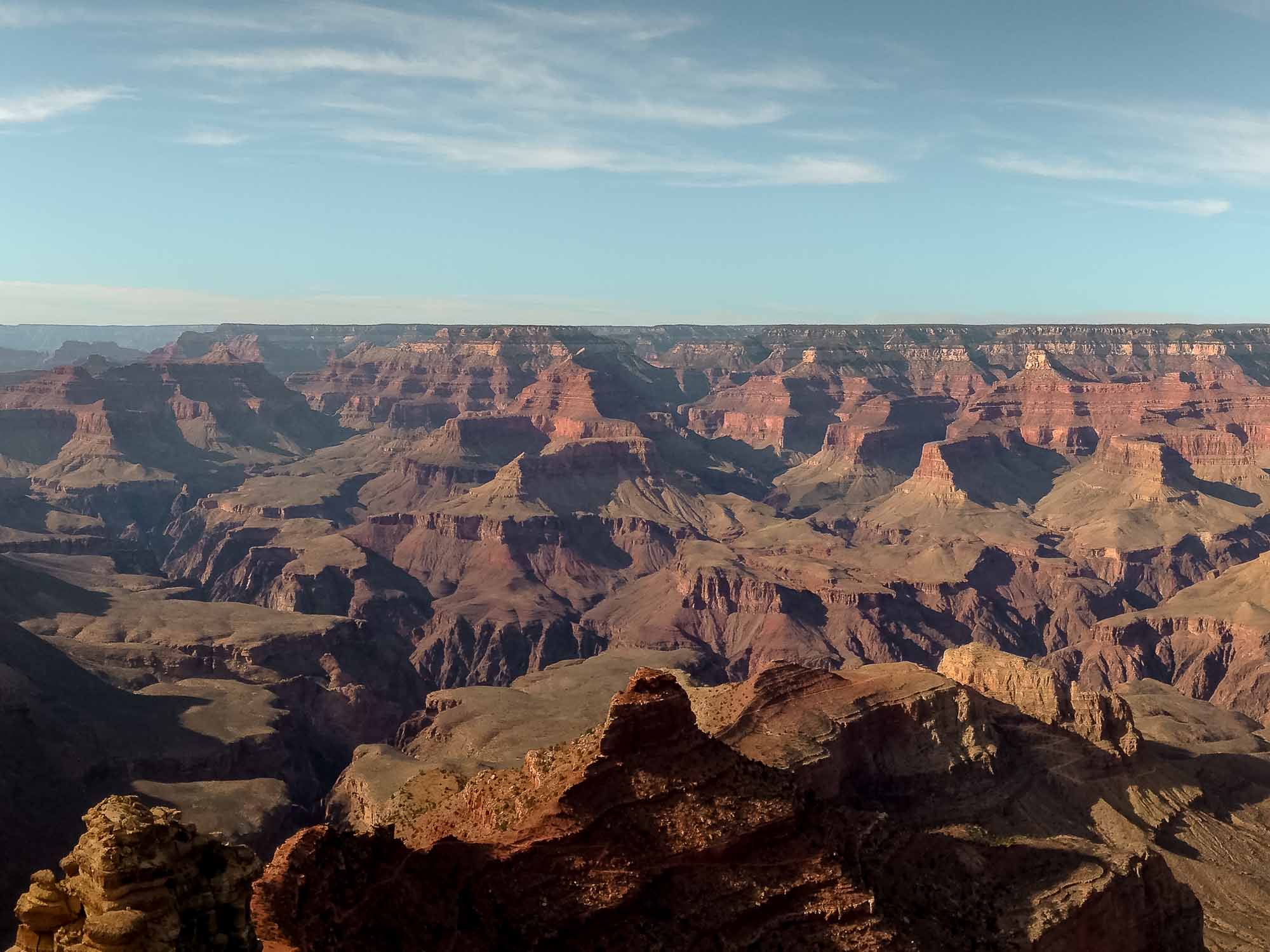
Can you find the arch in the photo below?

Sedona Arches FAQs
Which Sedona arch is easiest to get to?
Which arch in Sedona is the easiest hike?
Can I walk on the arches in Sedona?
What is the best arch in Sedona?
Ready to experience the energy that Sedona brings? Check here for the best prices on flights to Sedona. We recommend flying into Phoenix, renting a car, and driving the 1.5 hours to Sedona.
4 Arches in Sedona Hikes
- Devils Bridge
- Fay Canyon Arch
- Vultee Arch
- Soldier Pass Arch
Sedona Arches Map
1. Devils Bridge Arch
Gorgeous Hike + Most Popular
Location | 34.89762, -111.80769
Trailhead Parking | Mescal Trailhead
Parking Pass Needed | no
Hiking Distance | 4.4 miles out and back


Devils Bridge is a very popular hike in Sedona offering gorgeous views and an experience you can’t find anywhere else.
There are multiple ways to reach Devils Bridge, however, we suggest starting at Mescal Trailhead.
From Mescal Trailhead, take Mescal Trail to Chuckwagon Trail. Follow Chuckwagon Trail until it crosses the Dry Creek 4×4 road. At that point, cross the road, and you’ll see the Devils Bridge trailhead.
From here, you’ll start a slow and steady incline, followed by a couple of stair sections, and a walk along a ledge to this massive arch in Sedona.
We visited Sedona in the off-season, and during that visit, we had to wait to walk on the arch for 30 minutes two different times. Expect longer wait times if visiting on the weekends or during the high season.
We strongly suggest wearing grippy trail shoes like these here. They’re fantastic for climbing up and down the slick rock!

2. Fay Canyon Arch
Easiest Accessible Arch in Sedona
Location | 34.90973, -111.86119
Trailhead Parking | Fay Canyon Trailhead
Parking Pass Needed | no
Hiking Distance | 2 miles out and back


Fay Canyon is a fantastic canyon to hike in Sedona for families. The main Fay Canyon Trail is a flat trail, mainly made of sand.
For the majority of the trail, you hike along the main Fay Canyon Trail, however, when hiking to the arch, it’s all uphill, and a bit of a rock scramble.
Starting at the Fay Canyon Trailhead, cross the road and enjoy a flat and easy hike up into the canyon.
At .6 miles in, at the following coordinates, 34.908473, -111.862827, peel off the main trail and take the wash up to the arch. You’ll be hiking up the right side of the canyon at this point.
Don’t worry, if you pay attention to the right side of the canyon walls, it’s pretty obvious where the arch is. Likewise, the watch we recommend at the end of this will track your distance, so you’ll know exactly when to peel off the main trail system.
In the photo below, you can see a faint trail just above the rock next to me. You can also see the arch in the gap in the trees to the right of me!

3. Vultee Arch
Extreme Hike or Epic 4 x 4 Off-Roading
Location | 34.94146, -111.76873
Trailhead Parking | The end of Dry Creek Road
Parking Pass Needed | no
Hiking Distance | 3.6 miles out and back after 4×4 drive
Don’t want to hike to this arch, and are looking to rent a 4×4 vehicle? Check rental car prices and availability here.
We did not make the trek to Vultee Arch, so we can’t recommend this arch in Sedona.
However, we’ve read about it, and if you have a 4×4 high clearance vehicle, or are renting an ATV, this may be an awesome place to drive to!
From the end of Dry Creek Road (4.5 miles of off-roading), you’ll park and jump on a hiking trail. This is a nearly 4 mile hike round trip, so leave being prepared for a full-day adventure!
If you’d rather take on climbing up and over a mountain pass, and then returning back up and down the pass, to get to and from Vultee Arch, consider Sterling Pass Trail.
Taking Sterling Pass Trail, you’ll be hiking 4.4 miles round trip, with lots of switchbacks to get you over Sterling Pass.
4. Soldier Pass Arch
A Double Arch Inside a Cave
Location | 34.90077, -111.7857
Trailhead Parking | Soldier Pass | or shuttle from Possee Grounds
Parking Pass Needed | yes, at trailhead
Hiking Distance | 3.88 miles total out and back from trailhead | 5.88 miles total from Possee Park parking lot


Soldier Pass Trail is a hike in Sedona that doesn’t have much elevation gain but has beautiful views. Getting to the Soldier Pass cave and arch is where the difficult part of the trail begins.
While the entire trail is fairly easy, as you start to climb up to the Soldier Pass arch and cave, you have to start scrambling over rocks, and traversing some areas of slick red rock. We recommend these grippy trail shoes for this kind of hiking in Sedona.
There are a couple different ways to start this hike. You can Monday-Wednesday, you can park at the trailhead with a $5 parking pass (or National Parks Pass). If visiting outside of those days, you’ll need to take the Sedona Shuttle. The parking for this shuttle is at Possee Park.
Alternatively, if not during school hours, you can hike from the school parking lot next to the shuttle lot. This adds one mile each way to your hike, but it’s a great way to add easy miles and be able to walk through a neighborhood in Sedona.

Sedona Arches In Our Experience
Personally, I’m more impressed with the cliff dwellings and caves in Sedona than I am with the Sedona Arches However, that’s not to say they weren’t cool to see.
I’m always amazed at the beautiful red rock formations and the Creation behind it all.
Fay Canyon is a fun arch to hike to because there are so many people that just walk right on by. It gives you a bit of an escape from the crowds, even as crowds of people are passing on the trail below.
Devils Bridge was an awesome hike before sunset. The colors and views are fantastic. I think it’s a bit ridiculous to wait in line for a photo op, but hey, when in Rome! 😉
We’ll have to return to Sedona one day and hike to Vultee Arch. The images of it are pretty cool, but I’d be more after the uninterrupted hiking and quieter trail!

Snag Flights To Sedona Here
Have you booked your flights yet? We always use Momondo to book our flights, and it never fails to have the best deals on flights all across the globe.
Find and Compare Cheap Flights with Momondo Here!More On Sedona!
Sedona Vortex Sites | 7 Vortexes in Sedona
Sedona Guides | All Our Sedona Guides in One Place
Camping in Sedona | 12 FREE Dispersed Camping Near Sedona Locations
Keyhole Cave | A Complete Guide to This Sedona Cave (with a map)
Instagram for Sedona | 70+ Sedona Instagram Captions
Sedona Itinerary | One Day Sedona Itinerary From Sunrise to Sunset
Recommended Gear For Sedona
Find Our Complete Sedona Packing List With a Printable Checklist Here
Recommended Gear for Photography in Sedona
This is our complete photography gear guide, and most of these things came in super handy when shooting in Sedona.
We shoot with a Canon R5, and alternate between a wide-angle lens, this telephoto (zoom) lens, and this basic everyday shooter.
With harsh lighting mid-day, we threw on this filter for the lens to cut out some of the light.
Recommend Gear for Hiking in Sedona
These are hands down the best hiking shoes in Sedona. In fact, we did an entire post on them and what else to pack for hiking in Sedona here.
Grab the complete packing for Sedona checklist with links to all our gear here.
For all of our hikes, we used our Garmin watches to track our distance and Jay’s even tracks elevation. They both have features for contacting help if you fall or need it. So we love them!
Lastly, we used our maps.me app all the time! You can pin locations on it, and it has a lot of the trails (even the social ones) on it — making it the best trail app for Sedona!
Save + Share Here