

Hiking in Sedona doesn’t have to be strenuous and long. There are plenty of easy hikes in Sedona Arizona for that are flat and short, and still offer great views.
We’ve hiked hundreds of miles in Sedona, some times strenous full day adventures, other times bushwhacking through social trails, and still others just simple walks to a viewpoint to catch a gorgeous Sedona sunset.
Whether we were hiking with our cat, with kids, or just the two of us, we always made sure to take special notes of the difficulty of the trails we were on. Especially after we had read Cathedral Rock was considered an easy hike in Sedona, and it’s far from it.
This post is all about the truly easy hikes in Sedona, the ones that we rank as easy based on a physical therapist’s perspective on the trails. Each of the hikes has what area of Sedona they’re located in parentheses to help you decide if it’s the right area of Sedona based on other activities in your day.

This post contains affiliate links. As an Amazon Associate, we earn from qualifying purchases. If you buy through one of our links, we may earn a small commission at no extra cost to you. Read our full disclosure policy.
Make The Most Of This Easy Hikes In Sedona Guide
Pinnable Map App | We recommend downloading the free offline map app, Maps.me. After you download the app, you can download the Sedona region of Arizona. From there, you can pin each of the locations of trails you want to hike!
It’s a great way to visualize where these trails are located. See an example of how we use maps.me here.
Free Parking | At each of the places below that cost $5 for parking, you can actually get free parking if you have a National Park Pass. Be sure to pack it for your trip to Sedona. Alternatively, look into the Red Rock Pass multi-day and weekly parking pass options.
Elevation Gains | I did not list elevation gains for these hikes. It’s safe to say that if the hike is classified as easy, there is not much elevation gain. With that said, if there is elevation gain worth mentioning, I discuss it in the individual hike section.
Keep in mind, Sedona is already at elevation, so hiking will seem to be harder, even if it’s an easy hike!
Easy Vortex Hikes in Sedona
Red Rock Crossing/Budda Beach (West)
- Location | 34.82347, -111.79676
- Parking | Crescent Moon Ranch $12 | 34.8265568, -111.8083602
- Trail Guide | Red Rock Crossing Vortex Hike
- Duration | 2 miles out and back
- Terrain | well maintained path through woods and along the water
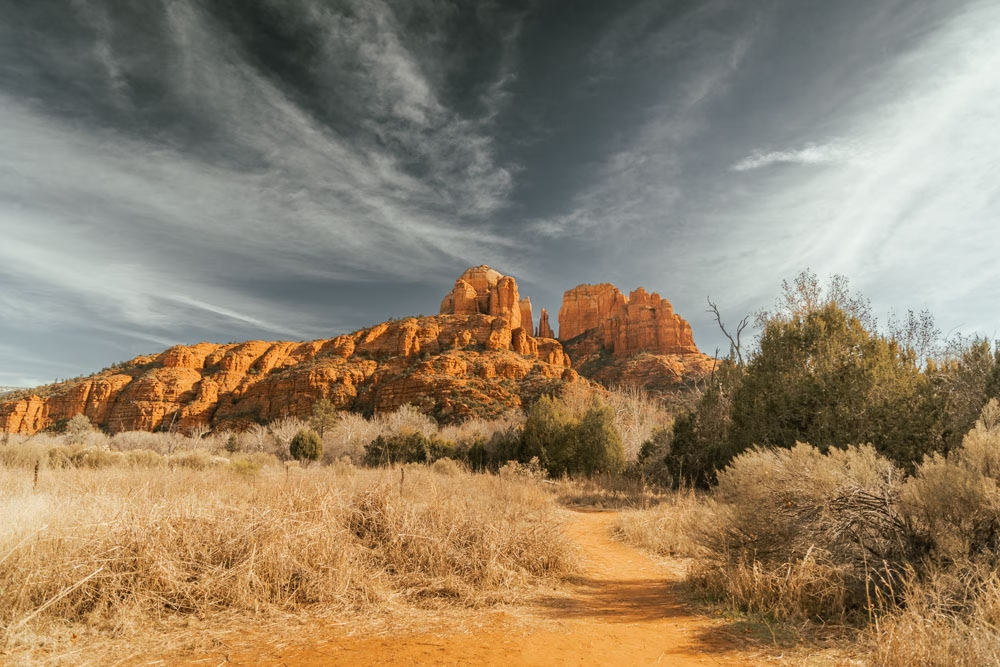
There are multiple different ways to hike the Red Rock Crossing trail, with many different areas to park, and varying levels of “easy” hiking.
This trail is mostly shaded and follows Oak Creek to great views of Cathedral Rock from below. There are places to swim, picnic, and lots of shaded areas to escape the heat.
While the easiest way to hike the Red Rock Crossing trail is to park at Crescent Moon Ranch, it’s 12 USD to enter the park, so we recommend these other parking areas for Red Rock Crossing.
Airport Mesa Vortex (West)
- Location | 34.855773, -111.779207
- Parking | free | 34.855725, -111.780269
- Trail Guide | Everything to Know When Hiking the Airport Mesa Vortex | parking and pictures of trail
- Duration | less than .5 miles out and back
- Terrain | stairs at beginning, then walking on uneven red rock with cable for handrail
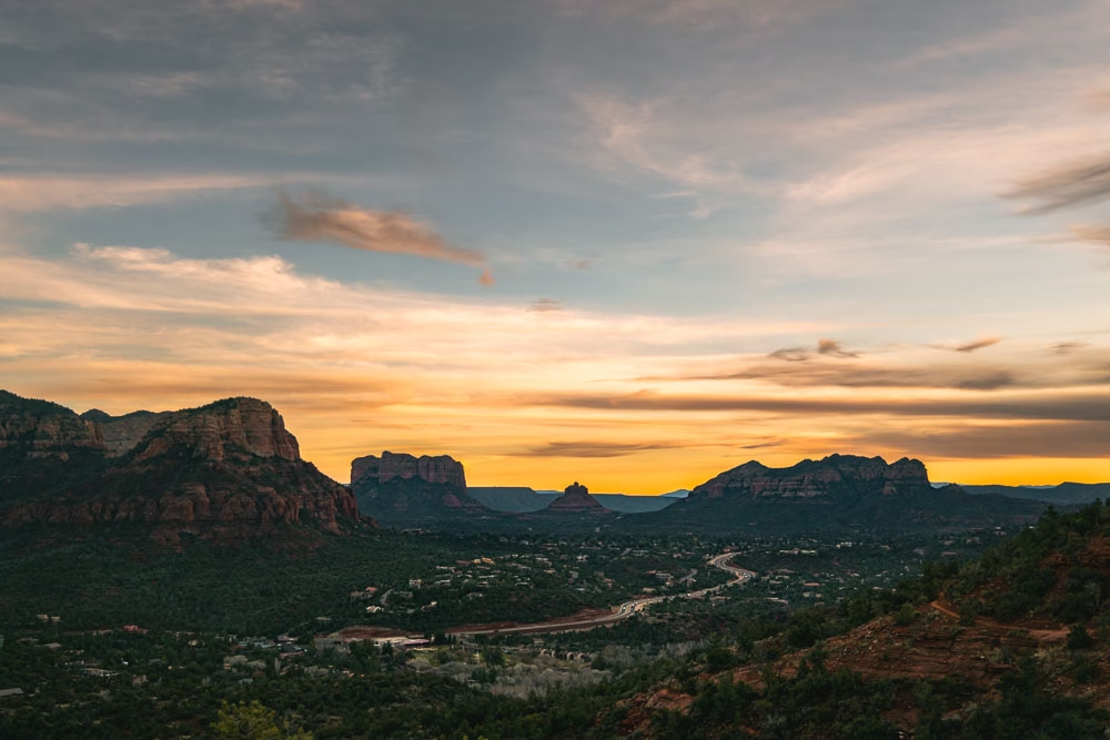
The Airport Mesa Vortex Hike is easy for the distance, but the trail involves some hiking on rocks. However, with the cable to hold onto, I’d still say this is an easy hike in Sedona.
Airport Mesa Vortex offers views both to the west side of Sedona as well as down to the Oak Creek side with Bell Rock and Courthouse Butte. We really enjoyed hiking to Airport Mesa for sunset, as the colors all around were beautiful.
The views you get from Airport Mesa Vortex for the effort put into the hike are unmatched in Sedona!
Chapel of The Holy Cross (Oak Creek)
- Location | 34.832001, -111.766902
- Parking | free | 34.832426, -111.765939
- Trail Guide | How To Access The Chapel Of The Holy Cross Vortex
- Duration | .25 miles out and back
- Terrain | paved

The Chapel of the Holy Cross Vortex is a very short paved walk from the base of the parking area up to the ramp to the chapel. If parking in the bottom lot, the incline can make this hike difficult for some, however, a free shuttle offers rides to the base of the chapel.
The entire trail is paved, so it’s fully accessible with those with mobility issues, and the views here are great.
Boynton Canyon Vortex (West)
- Location | 34.911741, -111.848234
- Parking | paid $5 | 34.907356, -111.848582
- Trail Guide | A Complete Guide to Boynton Canyon Vortex AKA, Kachina Woman Vortex
- Duration | 1 mile out and back
- Terrain | relatively flat until climbing up to vortex, sandy path

Boynton Canyon is easily one of the most popular areas of Sedona. And while I’d argue Fay Canyon is way better (more on that below) Boynton Canyon Vortex is an easy and pretty hike.
The most difficult part of hiking to Boynton Canyon Vortex is finding parking!
Once you reach Boynton Canyon Vortex, you can climb around on the red rocks as much as you’re comfortable with. It’s a fun hike to do with the family, as the kiddos can really explore climbing all over the base of this Sedona vortex.
In some ways, I’d not recommend doing this hike, as the parking situation here is really out of hand. However, if you can snag a parking spot, without ruining your car on the side of the road, it’s a pretty area.
Easy Sedona Hikes to Caves, Cliff Dwellings, or Wall Art
Raven Caves or Wind Caves (Oak Creek)
- Location | 34.841467, -111.780223
- Parking | free | 34.84192, -111.776332
- Duration | 1 mile out and back
- Terrain | rocky, and climbing through cave when you get there

Our first few times driving by Raven Caves there was nobody parked in this parking area. However, upon returning to Sedona, we’ve found this small parking lot to always have a handful of cars.
Raven Caves are some of the easier caves to get to in Sedona. The inside of them are fun to climb around in, but be weary of the ledges here!
Hiking to Raven Caves mid-day is part of our fun-filled one day itinerary for Sedona, but this hike would be good at any time of the day.
It’s worth noting, you cannot cross the highway to access Raven Caves from the south. You need to be coming from the north to have direct access to Raven Caves, otherwise, you’ll have to pass them, turn around and come back to the parking area.
Birthing Cave (West)
- Location | 34.913036, -111.836172
- Parking | free | 34.90657, -111.824171
- Duration | 2 miles total out and back
- Terrain | flat, sandy trail until climb into the cave

Birthing Cave is a one mile hike along a sandy trail to the base of a cave that’s rightfully named if you know what I mean! We’ve hiked to Birthing Cave twice, once with our cat Georgie, and found the trail to be easy.
With that said, there’s a bit of a scramble to get up inside the cave, so that part of the trail I wouldn’t consider easy. Georgie hiked up into the base of the cave without a problem, but getting into the cave we were hesitant to let her try, as it’s pretty slick in some places.
Birthing Cave is a popular cave hike in Sedona, and as such, parking here can be crowded and honestly weird. There’s not a real parking lot, but instead a lot of cars just jammed into openings between the trees. Be prepared for added hiking distance if the parking area is full.
Honanki Cliff Dwellings (West)
- Location | 34.939391, -111.933265
- Parking | $5 | 34.936783, -111.934413
- Honanki Guide | Be Sure To Read This Guide To Honanki Heritage Site Before Deciding To Go
- Duration | .5 mile loop
- Terrain | flat and sandy with some rock path
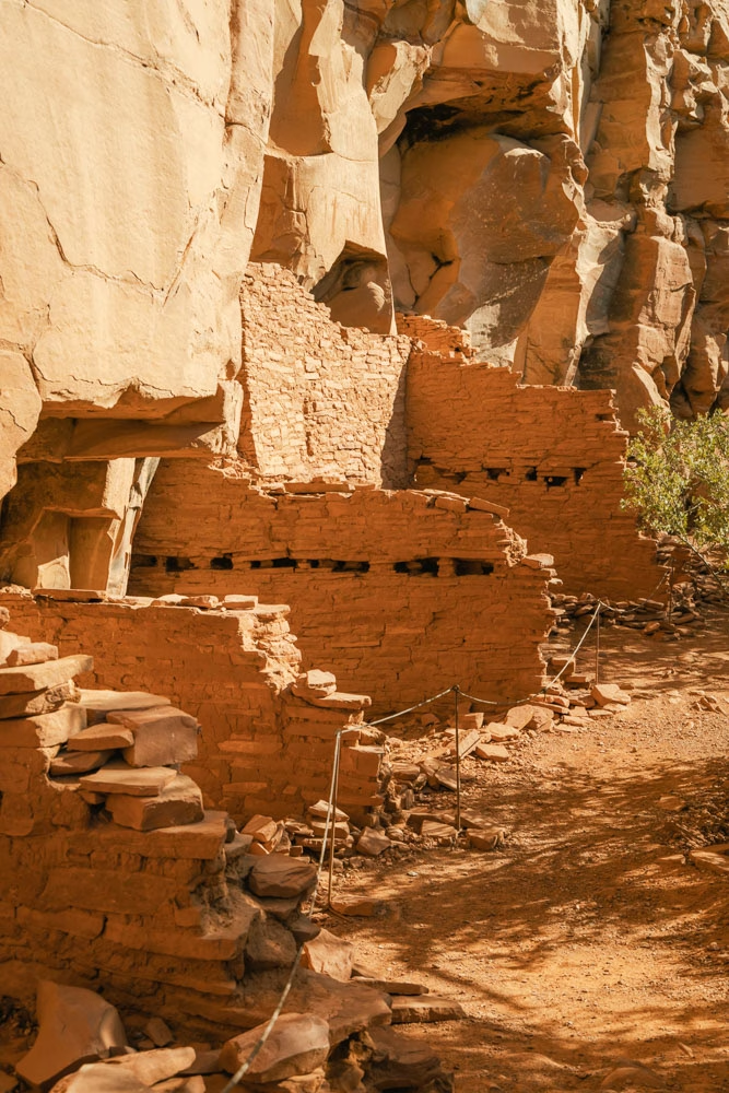
The trails leading to the Honanki Cliff Dwellings are relatively flat and really easy to hike.. however, the road getting to it is the complete opposite!
We camped at Nolan Campground and road our bikes to Honanki, as our van couldn’t make the drive. I’d suggest visiting Honanki only if you have high clearance, or you’re renting an ATV for the day and looking to explore some cliff dwellings!
The Honanki Cliff Dwellings are hands down the easiest cliff dwellings to hike to in Sedona… So it’s definitely worth the visit if you’re interested in the cliff dwellings.
Palatki Cliff Dwellings (West)
- Location | 34.915975, -111.902216
- Parking | $5 | 34.914668, -111.902496
- Palatki Heritage Site Guide | Booking Tickets + Need To Know Info For Palatki Ruins
- Duration | 1.5 hour tour
- Terrain | uneven rock steps
I’m a bit hesitant to include this on the easy hikes in Sedona list because while we were there, there was one person in our tour group that couldn’t do the entire hike.
I don’t know if he had medical problems or the heat was getting to him, but the hike to the Palatki ruins does include over 50 stairs made from red rock, and the red rocks can be wobbly… so definitely take that into consideration for this easy Sedona hike.
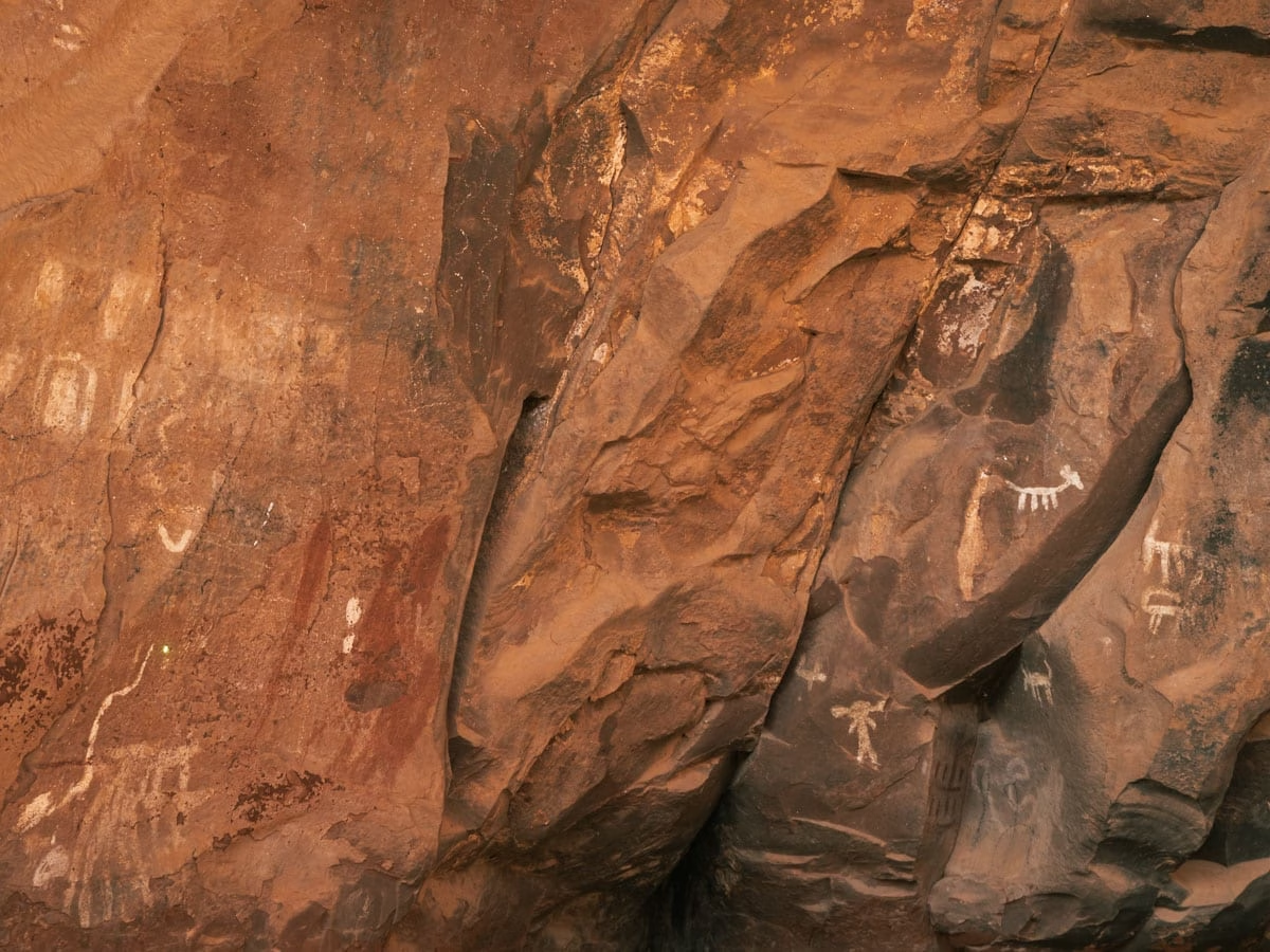
Palatki Heritage Site was the best heritage site in and around Sedona that we visited. The tour was super informative, yet didn’t feel like you were herded along like sheep. And you get to see both a great in tact ancient ruin as well as the largest amount of pictographs on one wall in the Verde Valley!
Crane Petroglyphs (Oak Creek)
- Location | 34.661091, -111.718594
- Parking | $5 | 34.665379, -111.716031
- Trail Guide | Crane Petroglyph Heritage Site Interesting Facts + More
- Duration | 1 mile total out and back
- Terrain | fine granite pieces, well maintain path

The Crane Petroglyph Heritage Site, originally named V Bar V Heritage Site, is a must-see in Sedona. Technically, it’s about ten miles directly south of Sedona, on the other side of I-17, but it’s still in the Sedona area, so we’re including it.
This easy hike offers a much different hiking experience than the other hikes on this list. From the parking area, the entire hike is on a fine granite path, that’s fully accessible for those in wheel chairs or bringing strollers.
There is no shade along this trail, and while it’s flat, we’d recommend still bringing water, as it gets hot fast — even in the winter in Sedona!
Easy Loop Hikes in Sedona Arizona
Sugarloaf Loop (Downtown West)
- Location | starts at parking lot
- Parking | free | 34.87429, -111.796447
- Trail Guide | Your Complete Guide to Sugarloaf Loop + Summit Trail
- Duration | 1.5 miles
- Terrain | red rock and sand

Sugarloaf is one of our favorite easy hikes in Sedona for both sunrise and sunset. The trail to the summit of Sugarloaf increases in elevation at a relatively slow rate, and the views from the top are incredible.
If you’re looking for a hike without elevation, there’s also a trail that goes around the base of Sugarloaf, offering great views all the way around.
Little Sugarloaf Loop / Lower Chimney Rock (Downtown West)
- Location | starts at parking lot
- Parking | free | 34.871849, -111.812115
- Duration | 1.5 mile loop
- Terrain | red rock and sand
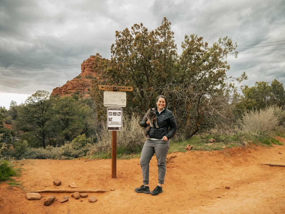
We found Little Sugarloaf Trail when we were attempting to hike Sugarloaf again, but the parking lot was full. So instead, we ended up parking in the Little Sugarloaf parking lot, and hiking again to the top of the red rock mound.
However, hiking to the top, would be considered more of a moderate climb, as the rocks are loose and there’s a bit of trail finding going on with that hike. Instead, staying low and circumnavigating Little Sugarloaf keeps this trail ranked easy, while offering great views of Thunder Mountain and the Red Rock Wilderness.
Bell Rock Loop (Oak Creek)
- Location | 34.803719, -111.765998
- Parking | $5 Court House Vista Trailhead | 34.805799, -111.766303
- Duration | 1.9 miles
- Terrain | red rock and sand
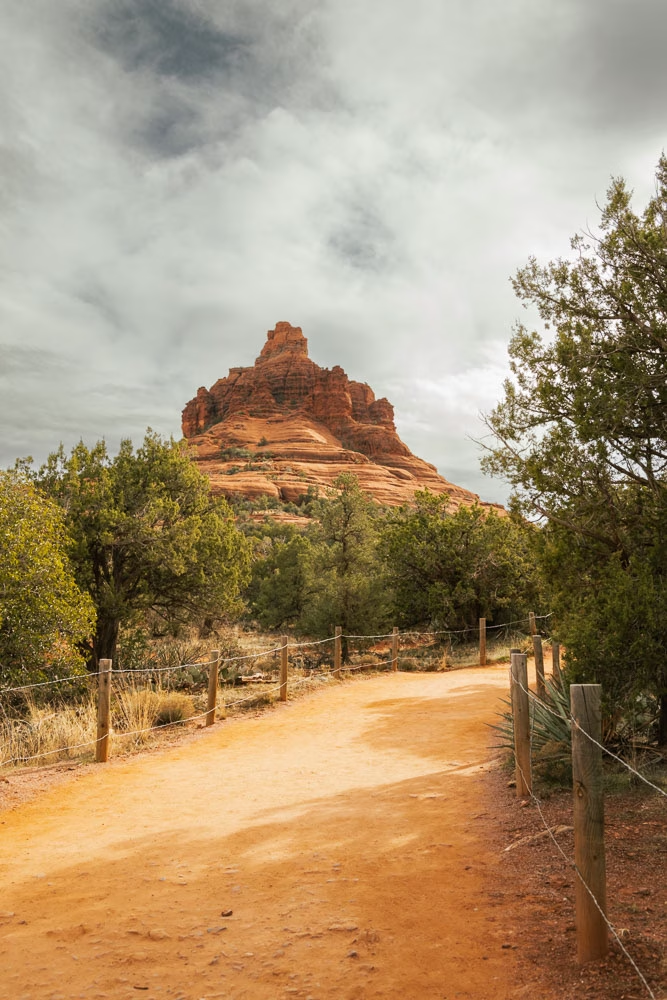
I’ll be the first to say, parking at Bell Rock is a nightmare! The best place to park for Bell Rock Loop is at Court House Vista parking, however, that parking lot fills up so quickly.. In our experience it was full by 8 am, with a constant stream of people circling the parking lot by 9.
If you park at Bell Rock Pathway parking, you can still hike this trail, or any variation of this trail, however nothing is shaded, and its HOT! Even in the winter!
We’ve rode and hiked on the Bell Rock Pathway multiple times, and can suggest hiking from Court House Vista over Bell Rock Pathway parking lot every time. The views are better, and you’ll have the chance to hike up onto the Bell Rock Vortex.
Courthouse Butte Loop (Oak Creek)
- Location | 34.803719, -111.765998
- Parking | $5 Court House Vista Trailhead | 34.805799, -111.766303
- Duration | 2.5 miles
- Terrain | sandy with some red rock steps

Courthouse Butte is the big towering rock formation in Sedona that can be seen from almost all areas of Sedona. It’s a beautiful behemoth of a rock, and hiking around it offers the chance to feel really small — in a good way.
The beauty of hiking around the base of a rock formation as large as Courthouse Butte is as you hike, your worries seem to melt away.
The trails all from Court House Vista parking are easy, and can be connected as you wish depending on how long you want to be hiking for.
With this hike, and the others in this area, it’s super important to remember it get’s hot super quick! Be sure to bring lots of water in a backpack like this for your hike!
Big Park Loop (Oak Creek)
- Location | 34.792087, -111.760219
- Parking | $5 Bell Rock Vista | 34.791536, -111.761695
- Duration | 2.5 mile loop
- Terrain | sandy with some red rocks

While the parking area for Big Park Loop is often crowded, doing this loop trail, you’ll likely not run into many other people.. as it’s easy to quickly space out from others.
This trail is a popular mountain biking trail, so be sure to be aware of riders coming up on you, and give them space.
Hiking the Big Park Loop, you’ll have views of Bell Rock, Courthouse Butte, Rabbit Ears, and the Munds Mountain Wilderness.
There isn’t much shade along this loop, so be prepared with sun protection and extra water!
Airport Mesa Loop (West)
- Location | starts at parking lot
- Parking | 34.855725, -111.780269 (main), or 34.854802, -111.797026 (alternative)
- Trail Guide | 3 Easy Hikes on Airport Mesa
- Duration | 3.34 mile loop
- Terrain | rocky spots with some ledges and minimal elevation gain
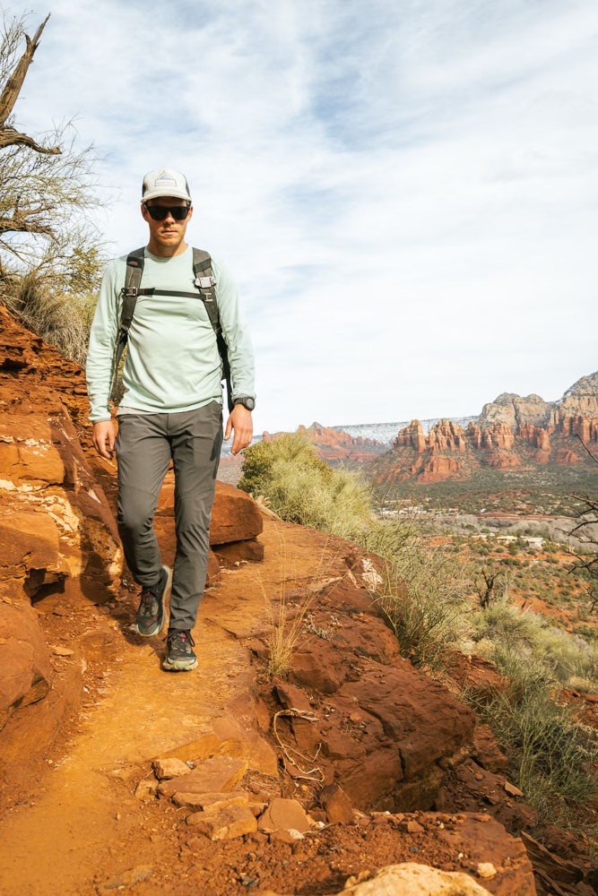
The Airport Mesa Loop Hike offers 360 degree views around Sedona, you just have to hike the 360 degrees around the mesa to see them all.
This hike took us by complete surprise. We saw a bobcat on this hike, evidence of javelina in the area, and were blown away with the great views the entire loop.
Airport Mesa is a big flat mesa in the center of Sedona, and the Airport Mesa Loop trail, goes just below the top of the mesa, all the way around it. You’ll have views of Cathedral Rock, Bell Rock, Courthouse Butte, Capitol Butte, and more.
The trail is just over three miles and is easy hiking that hits all the sweet spots of Sedona. You’ll hike amongst the cacti, red rocks, a vortex, and stunning views!
Easy Out And Back Hikes in Sedona
Secret Slick Rock (West)
- Location | 34.827656, -111.804155
- Parking | Free at Secret Slick Rock Trailhead | 34.8300784, -111.7994043
- Trail Guide | The Top Places To Watch Sunset In Sedona
- Duration | 1.16 miles round trip
- Terrain | rocky trail with one downhill to slick rock
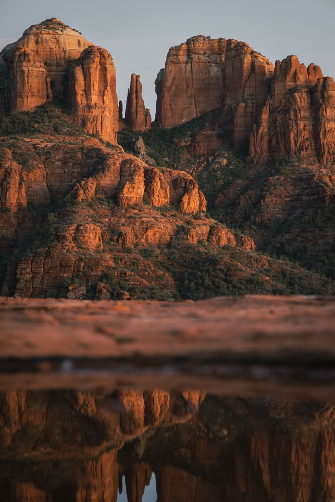
We stumbled upon Secret Slick Rock when Jay was researching photography locations in Sedona. After a heavy rain, Secret Slick Rock is easily one of our favorite spots for both an epic sunset in Sedona and photography in Sedona.
The trail to Secret Slick Rock is less than a half mile, and once you get to the slick rock, you can walk around and explore as you wish.. a great place for kiddos to run out some energy!
After a heavy rain, the divots in the slick rock collect the water and offer amazing reflection photography!
Oh, and did I mention, you have a beautiful view of Cathedral Rock from here!? It’s an absolute must easy hike in Sedona!
Chicken Point (Oak Creek)
- Location | 34.829026, -111.754801
- Parking | $5 Little Horse Trailhead | 34.824279, -111.776058
- Duration | 4.1 miles total out and back
- Terrain | relatively flat on a well-maintained trail the entire way

While the name Chicken Point implies a bit of a sketchy trail.. this trail is anything but that! Sunset from Chicken Point is beautiful, and the hike to it is fantastic too.
This hike starts our at Little Horse Trailhead, another busy trailhead in Sedona, but you can shuttle there, and then it slowly climbs up into the Munds Mountain Wilderness.
Hiking to Chicken Point, you’ll follow an easy trail and then before you know it, you’ll be engulfed in red rocks on all sides of you!
We didn’t see anyone else along the trail or up at Chicken Point, so it’s great for a bit of peace from the chaos Sedona can bring.
Baby Bell Rock (Oak Creek)
- Location | 34.807147, -111.762937 (top of Baby Bell)
- Parking | $5 Court House Vista Parking | 34.805799, -111.766303
- Duration | 1.5 – 3 mile lollipop loop
- Terrain | relatively flat, red rock and sand – can climb to top of Baby Bell
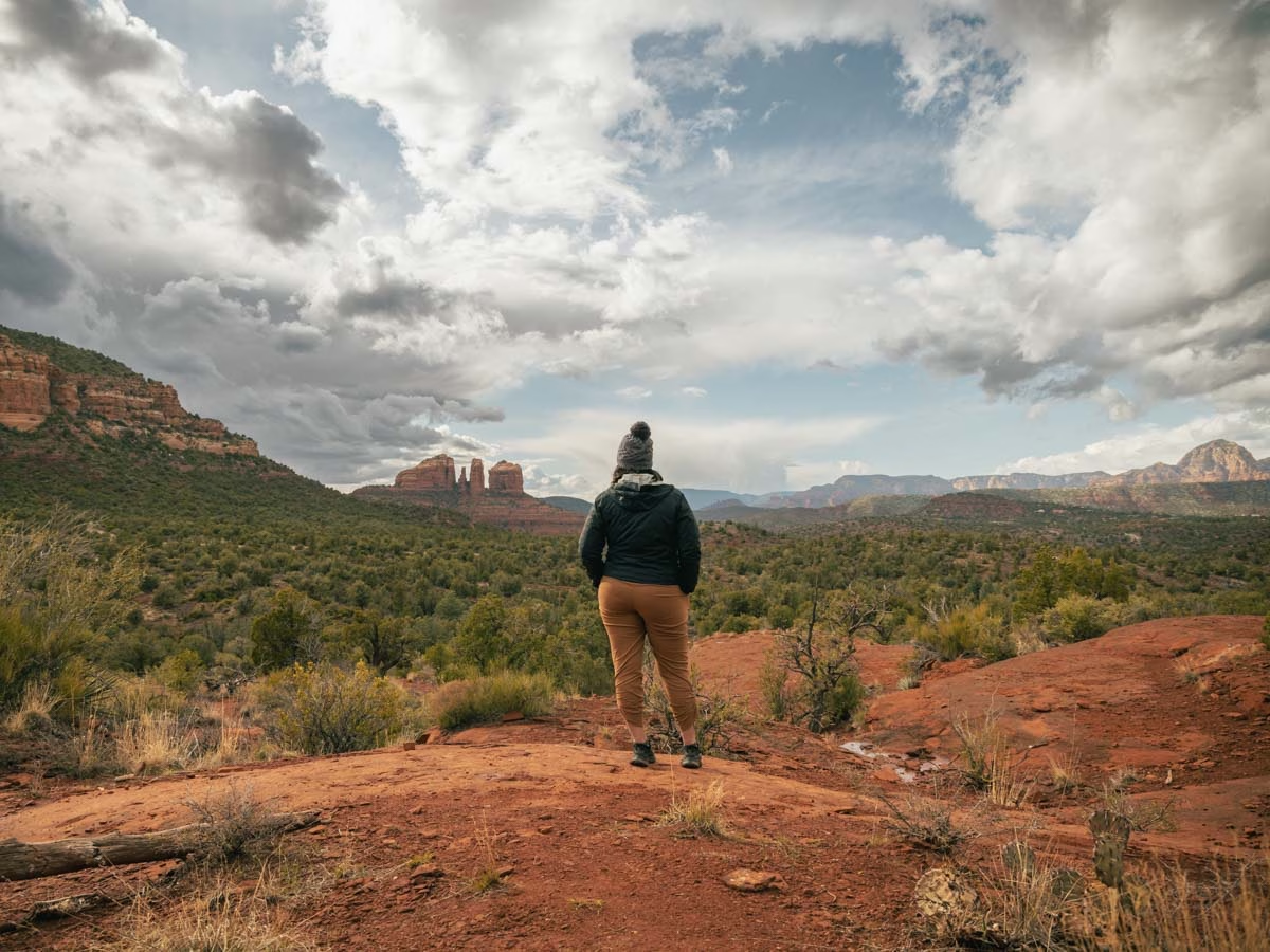
Hiking to Baby Bell Rock is a fun alternative to hiking up to Bell Rock. This trail leaves from Court House Vista Parking, but tends to be less crowded than the trails heading up to Bell Rock.
Along the trail to Baby Bell Rock, you’ll find one of our favorite 360 degree views in Sedona, offering a great look at Cathedral Rock.
The trail to Baby Bell Rock is along a mix of sand and flat slick red rock. Those looking for a bit of a more involved hike can add hiking to the top of Baby Bell Rock to the end of this easy trail.
Bell Rock Pathway (Oak Creek)
- Location | starts directly at both parking areas below
- Parking | $5 Bell Rock Vista | 34.791536, -111.761695 | $5 Little Horse Trailhead | 34.824279, -111.776058
- Duration | 6 mile total out and back, but can turn around at any point
- Terrain | well maintained gravel and sandy trail
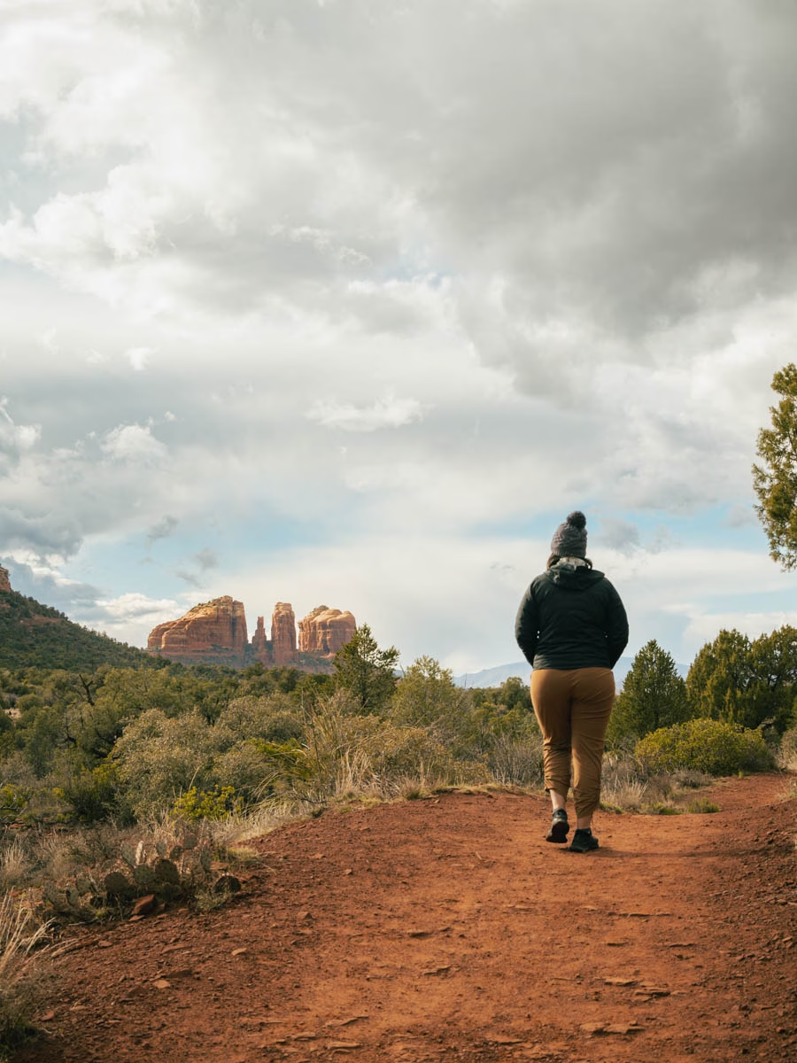
We absolutely love riding on the Bell Rock Pathway, but it would also make a very easy hike in Sedona. Most of the path is laid with fine granite or finely ground red rock, making it have very few trip hazards.
This path can be busy with cyclist, so they’re going to be the biggest worry along the trail.
The Bell Rock Path is wide and has intermittent shade, so prepare for a hot hike if heading out late in the day.
Fay Canyon (West)
- Location | 34.90172, -111.8578
- Parking | free Fay Canyon Trailhead | 34.901928, -111.857348
- Duration | 2 miles total out and back
- Terrain | mostly flat, sandy trail

Fay Canyon is my all time favorite canyon in Sedona. We have hiked so many different trails in Fay Canyon, but the simple Fay Canyon Trail is beautiful all on it’s own.
I’m not sure why so many people skip out on Fay Canyon, because in my opinion, it’s way better than Boynton Canyon, and the shade throughout the trail offers a great escape from the sun!
The Fay Canyon Trail leads hikers along a flat sandy path right smack in the middle of red rock canyon wall towering along both sides of the trail.
It’s insanely beautiful to hike right underneath the red rock walls.
There are a few social trails leading off of the main Fay Canyon trail, like the hike to Fay Canyon Arch.. but to keep this trail easy, just stay on the mail path.
Seven Sacred Pools & Devil’s Kitchen (Downtown West)
- Location | Trailhead | 34.884265, -111.783792 | Devil’s Kitchen | 34.886342, -111.782706 | Seven Sacred Pools | 34.890225, -111.785864
- Parking | free shuttle parking | 34.870899, -111.784458
- Jeep Tour | Seven Sacred Pools Jeep Off Roading Tour
- Duration | 2.2 miles
- Terrain | some steps, red rock trail

Seven Sacred Pools and Devil’s Kitchen are both along the Soldier’s Pass trail to the Soldier Pass arch/cave. And while the trail up to the arch is a moderate hike, the hike to Seven Sacred Pools and Devil’s Kitchen is easy.
This hike is made more difficult if you can’t catch the Sedona Shuttle to this trailhead, as that adds another one mile each way to the hike itself… though that entire mile is along a well-maintained trail and the side of the road.
At the beginning of the hike, you have to hike up and down a good amount of stairs, followed by hiking on a mix of slick rock and sandy trail.
However, the trail is well marked, is wide, and doesn’t have any surprising trip hazards along the way.
Seven Sacred Pools is definitely better after a bit of rain, otherwise the pools may be empty. But regardless of water in the pools or not, this hike is still a beautiful trail up into the red rocks.
Not interested in hiking this trail? Consider doing a jeep tour to the Seven Sacred Pools instead.
Yavapai Vista (Oak Creek)
- Location | 34.806442, -111.771198
- Parking | $5 at Yavapai Trailhead | 34.807357, -111.769405
- Duration | 1 mile total out and back
- Terrain | mix of rocky and sand

Oh my goodness, the Yavapai Vista is such an underrated trail in Sedona! We found this vista point when we were mountain biking, and decided we had to go back for sunrise, and it did not disappoint!
We were meeting friends at Bell Rock later in morning, so we parked at Court House Vista parking lot, and still found the trail to Yavapai Vista easy. However, you can park at Yavapai Vista Parking instead, making this a much shorter hike.
The trail has some trip hazards like rocks and roots, but they’re pretty obvious, and there’s not much of a climb for this hike.
Yavapai Vista is directly in the sun with very little shade, so keep that in mind if hiking during the day. We doing Yavapai Vista as a sunrise hike in Sedona, and think it would be pretty good for sunset as well.
Margs Draw Trail (Tlaquepaque)
- Location | 34.856638, -111.754648
- Parking | free at Marg’s Draw Trailhead | 34.856952, -111.760953
- Duration | 4 miles but can turn around whenever
- Terrain | climb on uneven stairs at beginning, then mostly flat, sandy trail
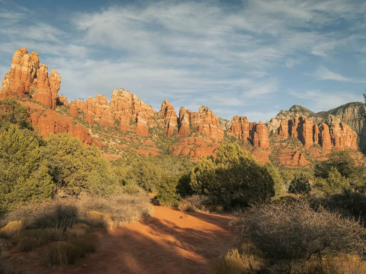
We have yet to hike the entire Marg’s Draw Trail. Each time we were hiking it, we took social trail detours, with us ending up on top of Snoopy Rock and some other cool rock formations in the area.
However, Marg’s Draw is a gorgeous trail on its own. Starting at the trailhead, there’s a climb with irregular steps up to get out of the canyon and on top of the red rocks.
That climb is very short, and is extremely rewarding, as finishing the steps leads to breathtaking views of Munds Mountain Wilderness.
Marg’s Draw is an out-and-back, and you can go in either direction from the parking lot connector trail, both lead to great views and both are easy hikes.
While most of the trail is relatively flat and decomposed soft red rock sand, there are some areas where you’ll be climbing up red rock steps, but those areas are few and far between.
If you do this trail.. you must hike to the following viewpoint, 34.857377, -111.753223. It’s straight across Margs Draw from the connector trail, and it’s beautiful!
Girdner or Centennial Trail from Cultural Park (Downtown West)
- Location | trails right from the parking lot
- Parking | free at Cultural Park | 34.852488, -111.831403
- Duration | varies for different loops
- Terrain | relatively flat, with some rocks
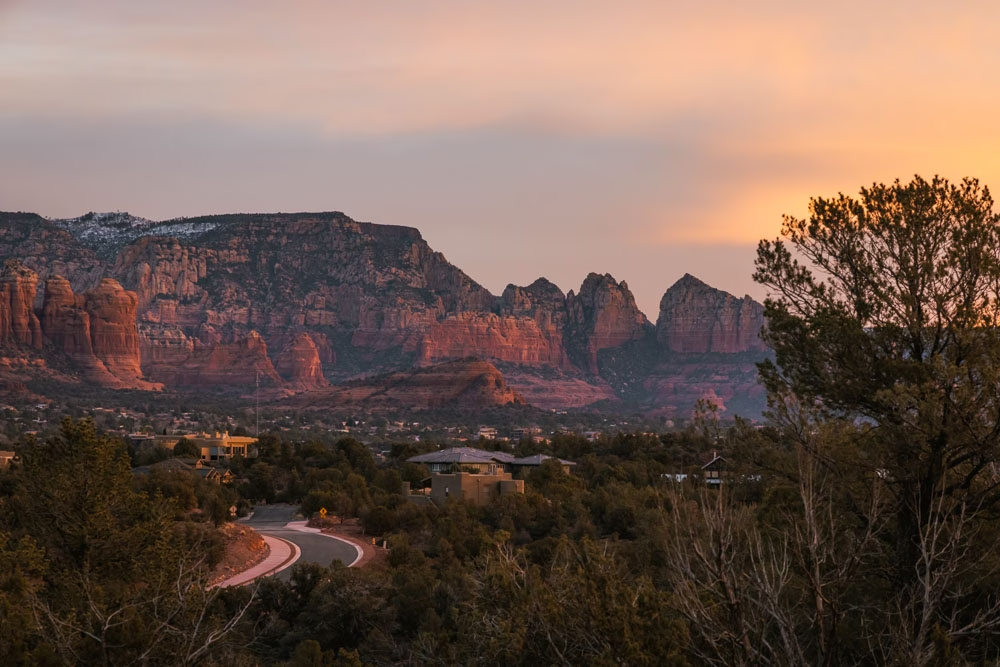
The Cultural Park area of Sedona West is a very underrated area. There are a lot of mountain biking routes from Cultural Park, but there are also a lot of great easy hiking trails.
The park itself has a covered picnic area and some benches to enjoy the Sedona views, and there’s a short interpretive loop with signs identifying plants along the way.
Hiking Girdner trail would be a very long, but rated easy hike — aside from the distance.. but instead of hiking the entire thing, check the map at the beginning of the trail and create your own fun and easy loop in the area.
You’ll be rewarded with great red rock views and few others on the trails.
Coffee Pot Rock (Downtown West)
- Location | starts from trailhead on Tea Cup Trail
- Parking | free at Sugarloaf Trailhead | 34.87429, -111.796447
- Duration | 2 mile loop
- Terrain | relatively flat, with sandy and some red rock

After a full day of work at the Sedona Library, our friend needed to take her pup out for an easy walk. We decided to head straight to the Sugarloaf Trailhead and hike out to Coffee Pot Rock.
This hike is relatively flat, but has little to no shade along the way.
You’ll have great views of Capitol Butte, and as you get closer to Coffee Pot Rock, the red rock formations will feel like they’re growing right in front of your eyes! It’s an optical illusion though, as you’re really just getting closer and closer to the base of them!
This trail is well marked, and can be made shorter or longer by looping in other trails in the area like Sugarloaf Summit, or Keyhole Cave (a short hike with trail finding).
Sedona View Trail (West)
- Location | 34.855725, -111.780269
- Parking | 34.855725, -111.780269 bottom, 34.852558, -111.789092 top
- Trail Guide | 3 Hikes On Airport Mesa
- Duration | .6 miles one way, 1.2 out and back
- Terrain | uphill one way on sand and rock trail

The Sedona View Trail is a short and easy hike in Sedona, that climbs from Airport Mesa Vortex to the top of Airport Mesa — right to the Sedona Scenic Overlook.
This trail is an out and back, and if you start at the Airport Mesa Vortex parking area, it’s all uphill on the way up, and all downhill on the way down. Obviously, that’s flipped if you pay the $3 to park at the top.
This trail has a couple of benches along the way, and offers views of Capitol Butte (Thunder Mountain) and into all of West Sedona. We particularly liked hiking this trail at sunset as it’s pretty to see Capitol Butte change colors while the city below starts to light up!
Keep in mind, there is no flat area along this trail.. it’s all a climb, so that’s worth considering if you think this will be easy for you.
Our Top 5 Easy Hikes In Sedona
Whew! That’s a lot of hiking talk! We’re so excited for you to hit the trails in Sedona. It’s truly a magical place.. minus the overuse of the area!
We recommend choosing a hike for you based on the location you’ll be in. Driving from one side of Sedona to the other can literally take over an hour.. even if it’s only 15 miles.
Be sure to plan your day accordingly, and always have a backup plan for if/when the trailheads are full.
The following are our top five favorite easy hikes in Sedona based on not just views, but also when considering the parking situation at each location.
Fay Canyon | Amazing views, and lots of parking that’s rarely full.
Secret Slick Rock | Away from the masses of people, and just gorgeous especially after a heavy rain.
Marg’s Draw | I’ve never seen this parking lot full, and the 360 views you get immediately after the climb are incredible.
Sugarloaf Summit | While there is a bit of elevation getting up to the actual summit of Sugarloaf, this area is really pretty to hike in, and if you can make it to the summit, the views for both sunrise and sunset are incredible. I’m hesitant to say this is easy, because there’s a lot of elevation gain to summit Sugarloaf.
Palatki Heritage Site | The drive out to Palatki Ruins paired with the super informative tour makes this easy hike in Sedona a must on my list!
Where To Stay in Sedona
The beauty of Sedona is found outdoors. And with incredible free camping in Sedona, we recommend those who visit Sedona to camp to really take it all in!
If you don’t have a tent and want to try out what it’s like to stay in an RV, check out these RV rentals from Phoenix!
Alternatively, check out these epic VRBO rentals in Sedona. The views from these houses are amazing!
What To Pack When Hiking In Sedona
It’s important to note, that no matter how easy or short the hike is, you should always be well prepared for heat and being on the trails longer than anticipated. With that said, these are the following items you should have with you when hiking in Sedona, all tucked into a hiking backpack so your hands are free to use on the hike.
If you’re interested in our complete packing list for Sedona, you can find that here.
Water | We love our CamelBak for hands free access to drinking water.
Grippy Trail Shoes | Nothing makes a hike easier, than having the best shoes for hiking in Sedona.
Snacks | High protein snacks, just in case the hike takes more out of you than you think.
Sun Protection | After my skin cancer diagnosis, sun protection is on my list for any kind of outdoor activity. And they make sun hoodies really cute now, so you can still be fashionable while you hike!
Other Sedona Guides
We’ve visited Sedona many times and each time have stayed for at least two weeks. In those times, we were sometimes hiking three to four trails a day, all to experience the beauty of Sedona, but also to collect first hand information to share with you.
These are some other Sedona guides we think will help make your trip to Sedona one for the books!
The Perfect Day In Sedona | from sunrise to sundown