

Short on time but want to squeeze in another hike? Check out these short hikes in Sedona! For each of these short hikes, we discuss parking situations, the general location, and the difficulty of the short hike.
Remember, just because it’s short, doesn’t mean it’s easy!

This post contains affiliate links. As an Amazon Associate, we earn from qualifying purchases. If you buy through one of our links, we may earn a small commission at no extra cost to you. Read our full disclosure policy.
Make The Most Of This Short Hikes In Sedona Guide
If you have any questions about these hikes, the quickest way to reach out to us is via Instagram, @ArboursAbroad. We’re happy to give more details and answer any questions!
Pinnable Map App | We recommend downloading the free offline map app, Maps.me. After you download the app, you can download the Sedona region of Arizona. From there, you can pin each of the locations of trails you want to hike!
It’s super useful to pin not just the trailhead location, but the actual point of interest, like the cave or viewpoint, and then also important spots along the trail that we give coordinates to where needed.
See an example of how we use maps.me here.
Free Parking | At each of the places below that cost $5 for parking, you can actually get free parking if you have a National Park Pass. Be sure to pack it for your trip to Sedona. Alternatively, look into the Red Rock Pass multi-day and weekly parking pass options.
Elevation Gains | I don’t include exact elevation gains in each of these hikes because when we would go inside caves or into canyons, our elevation got really skewed. If I rank the hike as easy, it’s safe to say there’s minimal elevation gain.
Keep in mind, Sedona is already at elevation, so hiking will seem to be harder, even if it’s a short and easy hike!
Packing | Even those these hikes are short, it’s hot in Sedona, Yes.. even during the winter. Be sure to pack water and snacks. We recommend packing them in a backpack, so you can use your hands while hiking. If you’re doing any of these hikes for sunrise in Sedona, or sunset, be sure to bring a headlamp.
Looking for easy hikes in Sedona? I’ve created this list of 25 easy hikes in Sedona, categorizing them by what each hike offers.
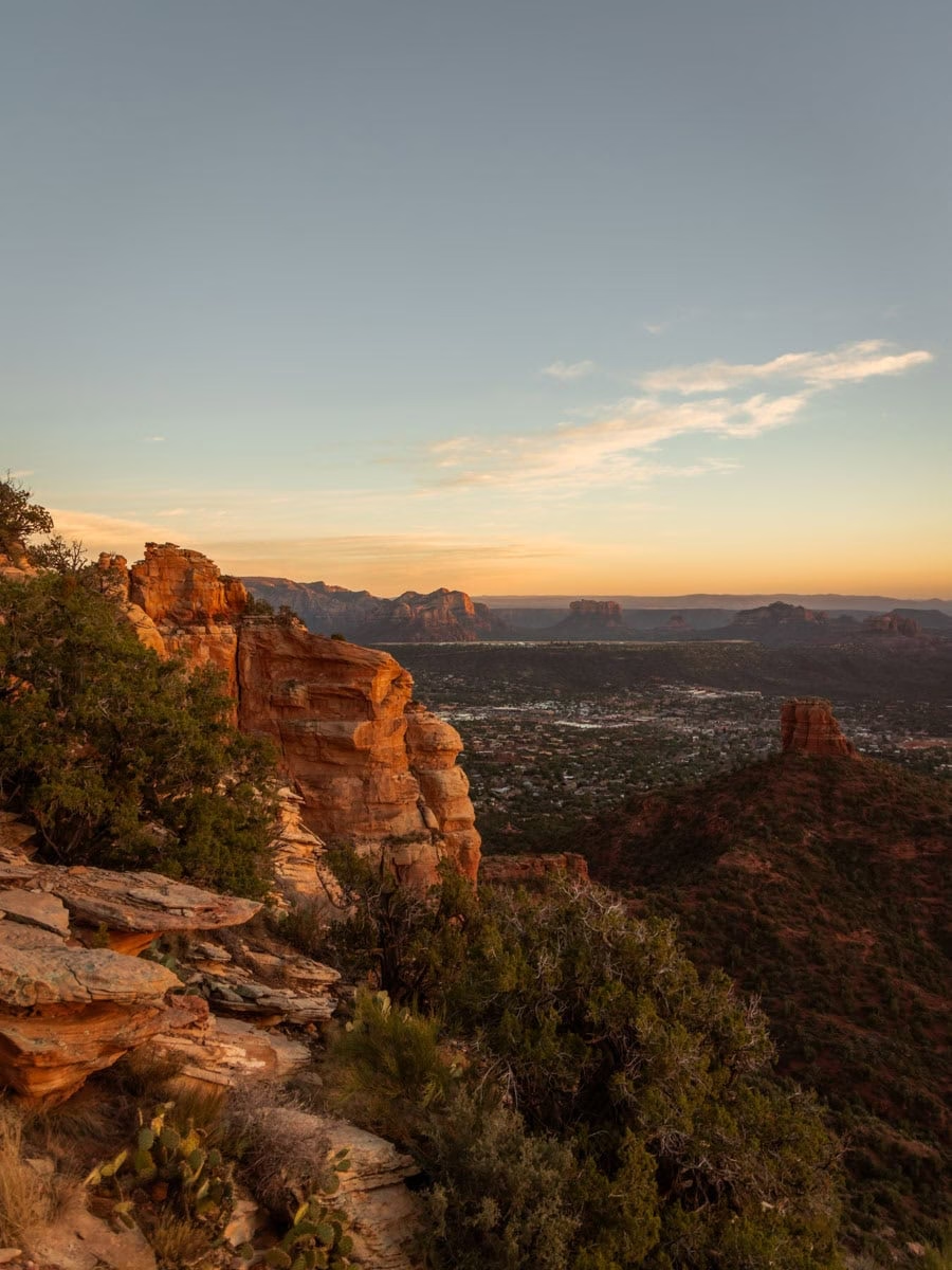
The 5 Best Short Hikes In Sedona In Our Opinion
- Snoopy Rock
- Keyhole Cave
- Altar Cave
- Lizard Head
- Cathedral Rock
Short and Easy Hikes In Sedona
Check out our complete list of 25 easy hikes in Sedona, Arizona, all of which are short hikes too!
Keyhole Cave (Downtown West)
- Location | 34.887286, -111.799163
- Parking | Free at Sugarloaf Trailhead | 34.87429, -111.796447
- Trail Guide | Getting Inside Keyhole Cave
- Duration | 2.31 miles round trip
- Terrain | sandy trail with trail finding and rock climbing to get inside the cave

Keyhole Cave was one of our first social trail experiences in Sedona. Which means, there’s not a real trail to Keyhole Cave on most maps.
However, the cave is actually easy to find, and if looking directly at the red rocks from the Sugarloaf Trailhead, you can actually see the cave!
The hike to Keyhole Cave starts at Sugarloaf Trailhead, and once you get to the “T” in the trail, you simply continue straight on the social trail until you reach the base of the cave.
Our detailed guide to this cave in Sedona talks more about the trail, with a lot more details in photos, but just know, it’s a pretty easy social trail – but getting into the cave is tricky and dangerous.
Fay Canyon (West)
- Location | 34.90172, -111.8578
- Parking | free Fay Canyon Trailhead | 34.901928, -111.857348
- Duration | 2 miles total out and back
- Terrain | mostly flat, sandy trail
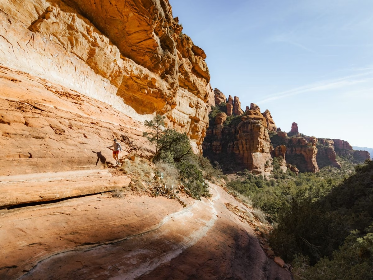
Fay Canyon is my favorite canyon in all of Sedona. You step onto the trail, and are immediately immersed inside red rock canyon walls.
The Fay Canyon Trail is a simple out-and-back along a relatively flat sandy path. However, what makes this canyon exciting is all the extra trails spur trails within Fay Canyon.
You can hike up to the Fay Canyon Arch in the middle of the trail, and at the end of the trail you can go both up the left and the right side of the canyon and explore!
The photo above is from the left side of the canyon.. and if you continue hiking and trail finding, you’ll find old ruins and epic views on top of the canyon!
To the right, there are also some great ruins to explore, and incredible views with not a soul around awaits those who trail find, rock climb, and bushwack up the wash.
Yavapai Vista (Oak Creek)
- Location | 34.806442, -111.771198
- Parking | $5 at Yavapai Trailhead | 34.807357, -111.769405
- Duration | 1 mile total out and back
- Terrain | mix of rocky and sand
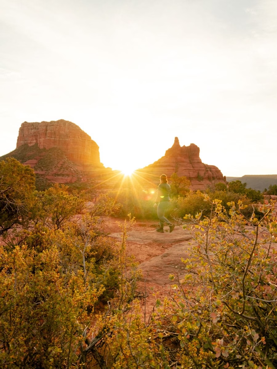
We found Yavapai Vista accidentally while on a bike ride, and we immediately looked at each other and said we have to come back for sunrise.
And let me tell you, it did not disappoint!
Yavapai Vista is a great short sunrise hike, and during the winter months in Sedona, you’ll get the sun rising right between Bell Rock and Courthouse Butte like in the image above.
We actually parked at Courthouse Vista Trailhead to do this hike, because we were coming from the south and meeting friends at Bell Rock later in the morning. However, there’s a trailhead called Yavapai Vista which would make this hike even shorter.
Both Courthouse Vista and Yavapai Vista parking areas fill up really quickly — in fact, they were full by 8am on multiple occasions, so plan to arrive extra early!
Sugarloaf Loop (Downtown West)
- Location | starts at parking lot
- Parking | free | 34.87429, -111.796447
- Trail Guide | Your Complete Guide to Sugarloaf Loop + Summit Trail
- Duration | 1.5 miles
- Terrain | red rock and sand

Sugarloaf Summit is a fantastic place to be for both sunrise and a Sedona sunset. And honestly, even though the lighting won’t be perfect, during the middle of the day this is a great hike as well.
Just be prepared with water and sun protection as there’s no shade along this trail or at the summit.
Sugarloaf starts off as an easy hike, with very little elevation until you begin the summit section of the trail. If you’re interested in hiking more than just to this summit, there’s a loop that goes around the base of the trail, and you can tack on things like Keyhole Cave or Coffee Pot Rock hikes as well.
Seven Sacred Pools & Devil’s Kitchen (Downtown West)
- Location | Trailhead | 34.884265, -111.783792 | Devil’s Kitchen | 34.886342, -111.782706 | Seven Sacred Pools | 34.890225, -111.785864
- Parking | free shuttle parking | 34.870899, -111.784458
- Jeep Tour | Seven Sacred Pools Jeep Off Roading Tour
- Duration | 2.2 miles
- Terrain | some steps, red rock trail
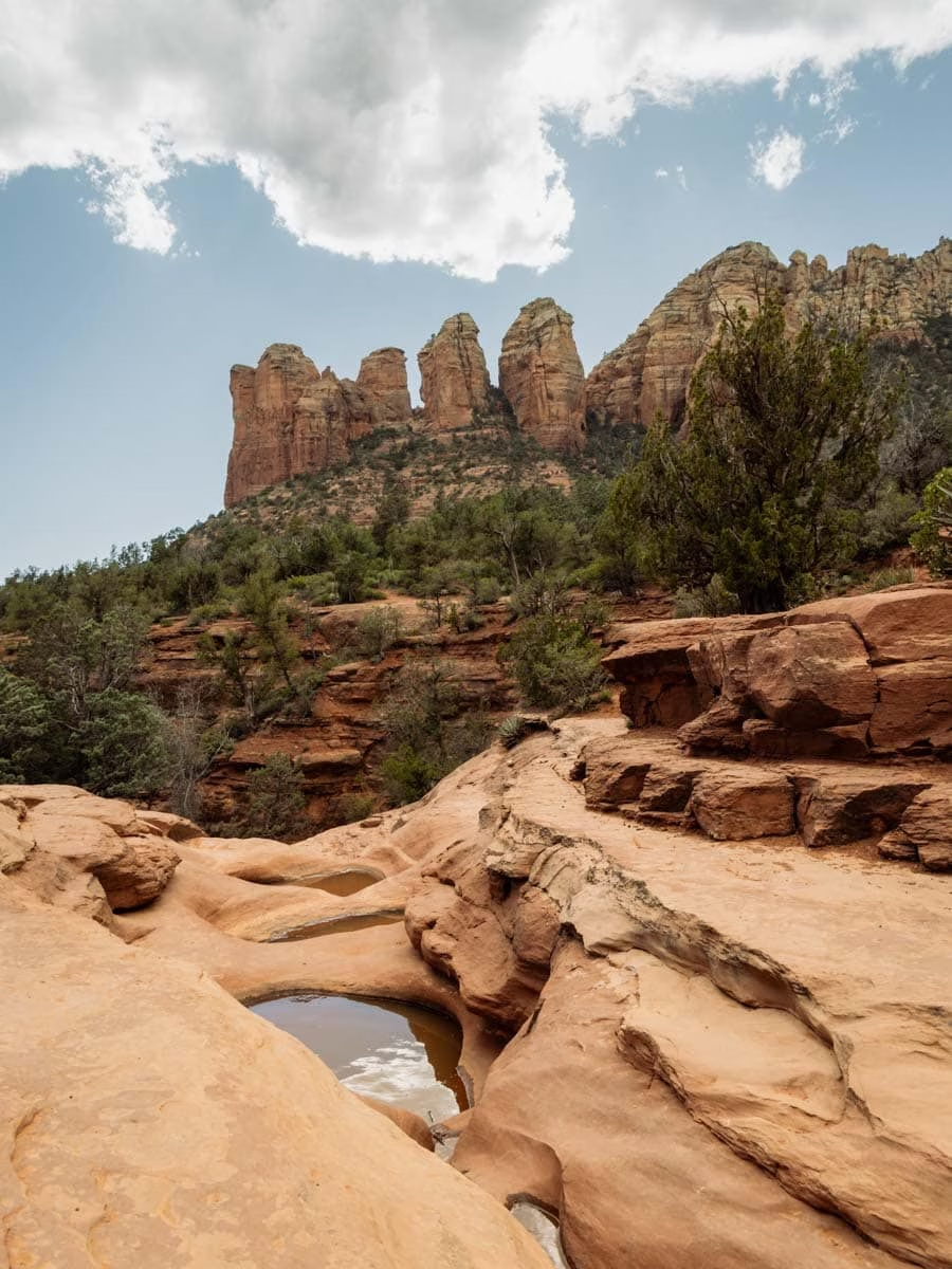
While this is certainly a short trail in Sedona, it’s worth mentioning that the parking for this trail is at a shuttle stop, and then you have to get on the shuttle, which doesn’t run frequently, thus making this hike take much longer than suggested.
Seven Sacred Pools and Devil’s Kitchen are both along the Soldier’s Pass trail, and there’s a cave not too far past Seven Sacred Pools, adding about a mile to your hike.
Check the shuttle times and days here, and while the hike is short, prepare for this hike to be a half-day adventure.
Looking for more of an adventure? Check out this off-roading tour to Seven Sacred Pools.
Wall of the Ancient Rock Art (Far West)
- Location | 34.941757, -111.918899
- Parking | free at Loy Canyon Trailhead | 34.932065, -111.925126
- Duration | 2 miles total out and back
- Terrain | flat, sandy trail, then up a wash to the rock art wall
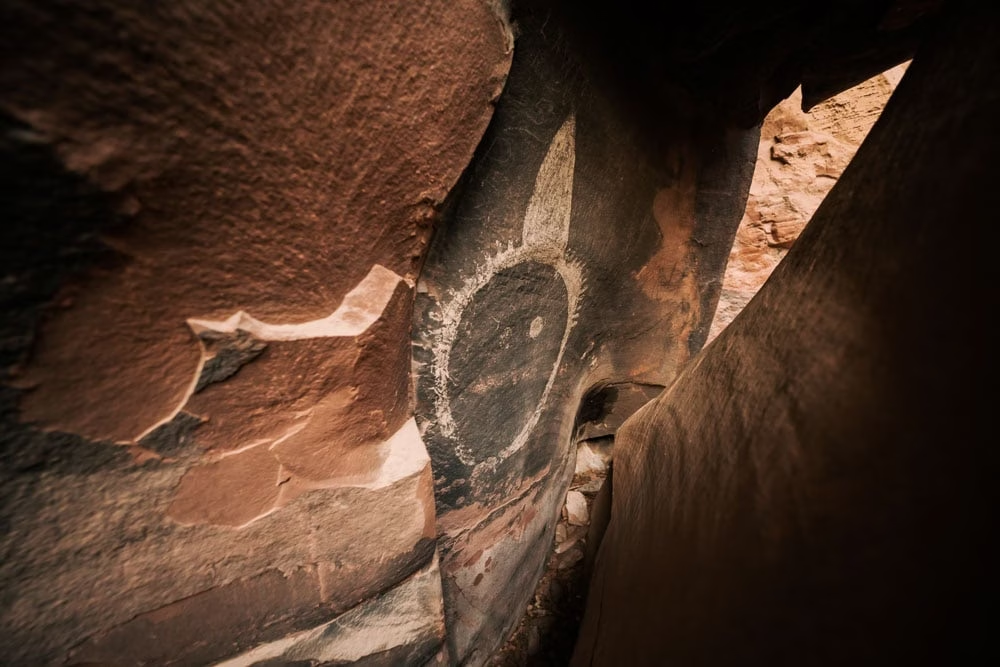
This hike is a super special hike because not too many people venture out to this area of Sedona.
Loy Canyon is roughly ten miles out of Boynton Canyon Road, down a rough dirt road (high clearance recommended), but it’s stellar! The canyon itself is beautiful, and the Wall of the Ancient Rock Art is a sight to see!
The trail to the wall art wall is a social trail off the main Loy Canyon trail, and you’ll need to turn right off of Loy Canyon trail at the following coordinates; 34.939789, -111.924547. The trail is on Maps.Me if you’re concerned about doing this hike on a social trail.
For the most part, this trail is pretty easy, it’s just a little bit of trail finding as you get closer to the art wall.
Birthing Cave (West)
- Location | 34.913036, -111.836172
- Parking | free | 34.90657, -111.824171
- Duration | 2 miles total out and back
- Terrain | flat, sandy trail until climb into the cave
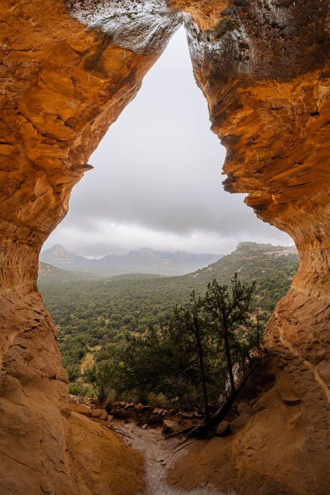
Birthing Cave is one of the most popular cave hikes in Sedona. It’s a really easy hike to the base of the cave, but to get inside and get the image above it’s tricky.
The hike follows a wide sandy path until the climb to get to the base of the cave. From there, it’s a rock scramble to walk inside the cave, which these shoes are super helpful for.
If you are doing this hike for photography, be sure to bring a wide-angle lens. To capture the entire cave, you’ll either need a wide angle, or be able to put together multiple images to create one photo.
Red Rock Crossing Via Secret Slick Rock (West)
- Location | 34.827656, -111.804155
- Parking | Free at Secret Slick Rock Trailhead | 34.8300784, -111.7994043
- Trail Guide | The Top Places To Watch Sunset In Sedona
- Duration | 2.6 miles round trip
- Terrain | rocky trail with mixture of sand and red rock
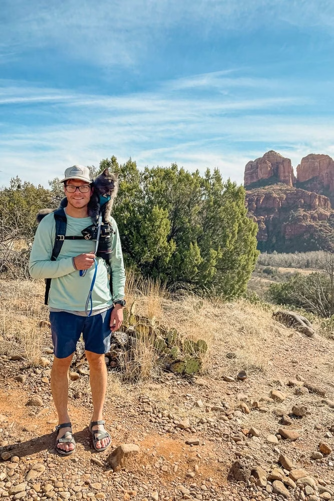
Red Rock Crossing is where the iconic photo of Cathedral Rock reflecting off of Oak Creek is captured. But there is so much more beauty in this area.
We really enjoyed making the hike to Red Rock Crossing a bit longer by starting at Secret Slick Rock, one of our favorite sunset locations in Sedona.
This is a great loop hike that starts in the sun, then dips down into the shade and along the creek — making it perfect to do if the weather’s warm and you’d like to swim!
If you go into Crescent Moon Ranch via the car entrance, you must pay to enter. However, there are trails closer to the creek that skirt around the edge of the ranch/picnic area instead of walking into the park.
Moderate, Yet Short Hikes In Sedona
Little Sugar Loaf Summit (Downtown West)
- Location | 34.872682, -111.815559
- Parking | free at Thunder Mountain Trailhead | 34.871849, -111.812115
- Duration | 1.2 miles total out and back
- Terrain | sandy at the beginning, loose rock scramble to summit

We found the trail to Little Sugarloaf after actually attempting to go to the regular Sugarloaf trail, and finding the trailhead parking full. But this ended up being a sweet surprise.
This trailhead isn’t as busy as other ones in the area, and there are multiple different hikes from here. If you don’t want to do the elevation gain up to the summit on loose rock, then you can instead hike around the base of Little Sugarloaf.
If you’re comfortable with hiking on loose rock and sand, then hiking to the summit is well worth the climb, as the views are incredible.
Doe Mountain (West)
- Location | 34.890154, -111.856546
- Parking | $5 Bear/Doe Mountain Trailhead | 34.893448, -111.865196
- Duration | 2 miles round trip
- Terrain | switchbacks on uneven rocks
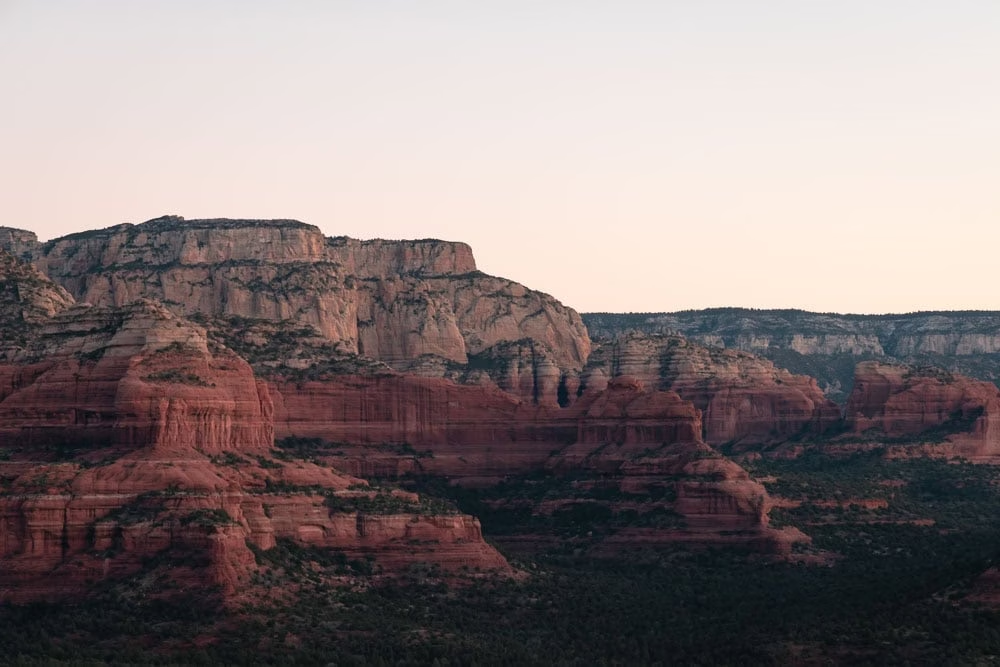
Doe Mountain is a great sunrise hike in Sedona. Right from the get go there’s multiple switchbacks to get you up the mountain, then you’re hiking to the edge across the big Doe Mountain mesa.
The trail gets to the edge of the mesa offering views of the red rocks like in the image above, but we recommend if time allows to hike along the edge of the mesa, finding a spot further away, so you can enjoy the views without too many others around.
You’ll also find, that walking to the right clockwise around the mesa you’ll be greeted with great views of town and even hot air balloons if hiking at sunrise.
Cathedral Rock (Oak Creek)
- Location | 34.81775, -111.7925
- Parking | $5 Cathedral Rock Trailhead (Mon-Wed) | 34.825141, -111.788297 | or free shuttle (Thurs – Sun)
- Duration | 2.3 miles
- Terrain | slick rock with climbing on hands and knees for some portions

I have a love hate relationship with Cathedral Rock. It’s clearly a beautiful trail, and the hike is really fun — but it’s a hot mess to access, and I can’t imaging doing this hike when it’s busy with having to wait in line for the shot above.
It’s also so tricky to get to with the *not so great* shuttle system for Cathedral Rock. If visiting in the high season, the shuttle runs daily, but ends well before sunset, so you won’t be able to see the best lighting in this area.
However, you can hike to Cathedral Rock from Baldwin Trailhead, Little Horse Trailhead, or Yavapai Vista Trailhead, those will each just add a considerable amount of distance to this hike.
We somehow managed to do this hike when the parking lot for Cathedral Rock was open, but when we went back to do it again, the parking lot and road to the parking lot were closed, even when the shuttle wasn’t running.
With how busy this hike can get, I would suggest having a backup plan, if you can’t find parking!
Bell Rock Vortex (Oak Creek)
- Location | 34.80037, -111.7662
- Parking | $5 Court House Vista Trailhead | 34.805799, -111.766303
- Duration | .2 – 1.5+ miles
- Terrain | rock scramble and climb to top, or stay at bottom for easy hike
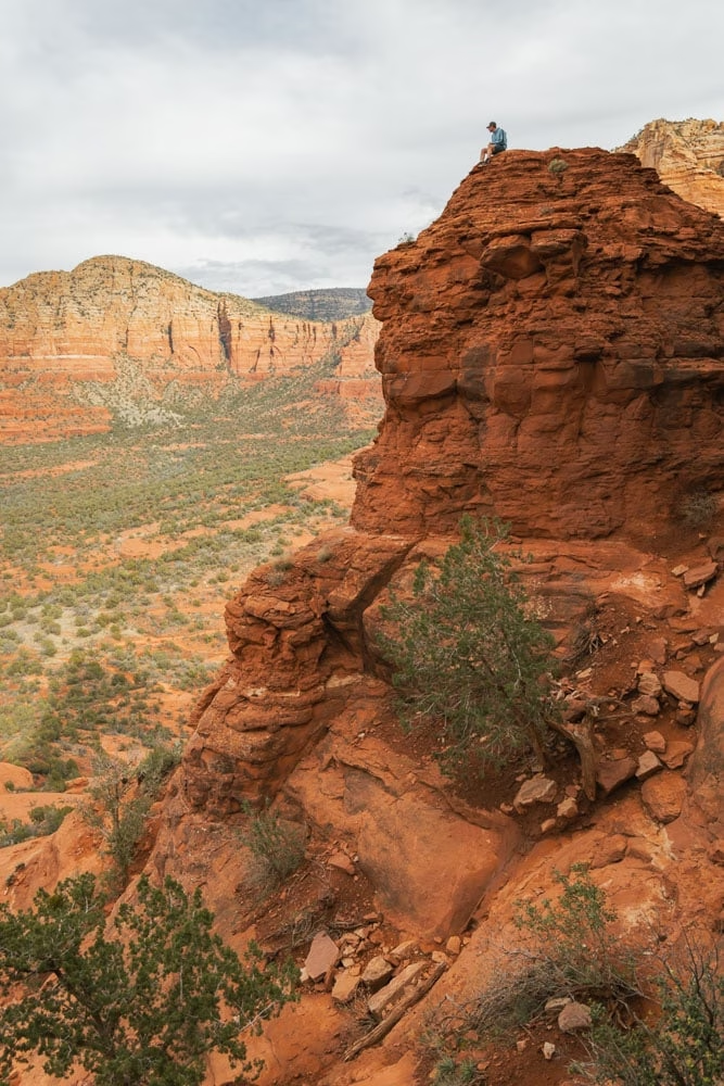
Bell Rock is a trail in Sedona that the entire family can enjoy! It’s also a trail that you get to decide how long you make it, where you go, and how much you push yourself.
We’ve been to Bell Rock more than a handful of times, and each time we climb up Bell Rock from a different approach. It’s always a fun climb, and the views never get old.
To hike up Bell Rock, we suggest parking at the Court House Vista trailhead, as this puts you right at the base of Bell Rock without the extra hike.
This area is extremely busy. People circle the parking lot like vultures here, so pack your patience, and if you can, arrive before sunrise to secure a parking spot.
Did you know, Bell Rock is actually one of the vortex sites in Sedona?! You’ll likely see people meditating, doing sound baths, and more here.. so be sure to visit respectfully.
Interested in meditating at Bell Rock and other places in Sedona? Check out this guided meditation tour in Sedona.
Scheurman Mountain (West)
- Location | 34.843074, -111.835989
- Parking | free | 34.847021, -111.828506
- Duration | 2 miles total out and back
- Terrain | mixture of rock and sand, all uphill
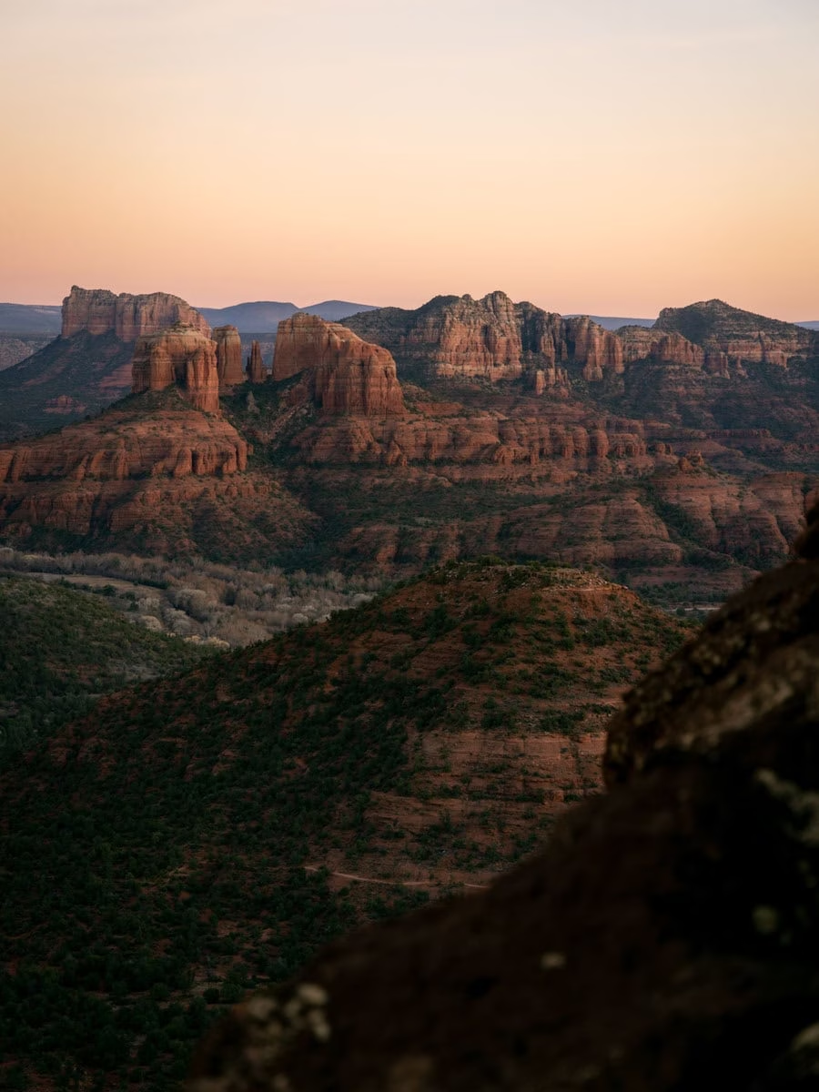
We didn’t hike up Schuerman Mountain until our most recent trip to Sedona, and I’m only left wondering why. This hike is a really pretty trail, which you’ll likely not see many tourists on, and the sunset views from here are fantastic.
I would be the sunrise views from Schuerman Mountain Vista are great as well.
While this hike is short, it’s all uphill… and seemingly uphill at a pretty fast rate! I carried Georgie up the mountain and had to stop a couple times for a break!
Difficult, Yet Short Hikes In Sedona
Snoopy Rock (Tlaquepaque)
- Location | 34.856638, -111.754648
- Parking | free at Marg’s Draw Trailhead | 34.856952, -111.760953
- Trail Guide | How To Get To The Top of Snoopy Rock in Sedona
- Duration | 2 miles out and back
- Terrain | climb on uneven stairs at beginning and rock scrambling/climbing at the end

Hiking to the top of Snoopy Rock we actually did on accident! We had just returned to Sedona, and were after an easy hike in the area.
However, after hiking up the Margs Draw connector trail and seeing there was a social trail straight ahead, we knew we had to take it!
Snoopy Rock is a pretty easy social trail to follow. Starting at Margs Draw Trailhead, instead of hiking on Margs Draw, go straight, perpendicular to the trail, and you’ll be on your way.
The trail turns into a mix of multiple trails weaving their way up the rocks, but if you hike up and to the left, you’ll eventually get to the top.
We talk about exact coordinates and more things to look for while hiking Snoopy Rock here, which we genuinely suggest checking out before doing this short hike in Sedona.
Altar Cave (West)
- Location | 34.905894, -111.840728
- Parking | $5 Boynton Canyon Trailhead | 34.907473, -111.848660
- Trail Guide | How To Find Altar Cave and 4 Other Caves Along The Way
- Duration | 3 miles round trip
- Terrain | sandy trail with rock climbing to get inside caves
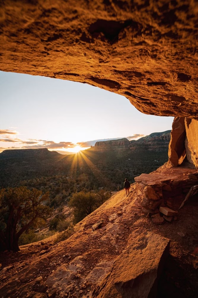
The Altar Cave hike is a relatively easy hike, but we rank it as moderate as there is some rock climbing involved to get up to the red rock level the caves are on.
There are actually five different caves on the way to Altar Cave, making it a really fun day on the trails.
We recommend doing this hike at sunset for a couple of reasons. Obviously, the sunset views are amazing, but the chances of finding a parking spot at the Boynton Canyon trailhead are higher, as people are typically getting off the trails at this time!
Lizard Head (West)
- Location | 34.88367, -111.815813
- Parking | $5 Dry Creek Trailhead | 34.889958, -111.820538
- Duration | 3 miles round trip
- Terrain | large rocks to step up to and uneven climb straight up a cliff

Lizard Head trail is a flipping epic trail in Sedona! The views will leave you breathless, and the serenity up there as you watch the chaos drive by is priceless.
When we hiked Lizard Head the first time, we didn’t want to mess with parking at all at Dry Creek Trailhead, so we started the hike from Andante Trailhead. This adds a couple of miles to the hike, but arguably, it’s still a pretty short hike.
Starting at Dry Creek Trailhead, this hike is less than three miles round trip, but be prepared for some serious elevation.
To get to Lizard Head (the top) hike the Lizard Head trail and take the social trail which leaves the trail at, 34.88581, -111.820443. This is where the serious elevation awaits.
You literally climb up and over rocks and trees, through bushes, and scramble your way to the top.
Jay ran up the trail to beat the sunset, and I made my way slowly up the trail (the elevation is intense), but made it to the top with literally two minutes until the sun dipped below the horizon!
This is a super fun and short trail right in the heart of Sedona.
Capitol Butte (West)
- Location | 34.886007, -111.806874
- Parking | $5 Dry Creek Trailhead | 34.889958, -111.820538
- Duration | 3 miles round trip
- Terrain | rock climbing, large rocks to step up to, and uneven climb straight up a cliff

To be completely honest, we never knew you could get to the top of Capitol Butte until we hiked up Lizard Head. We met someone on the hike who said he was coming down from Capitol Butte summit.
We both were shocked.
Later that week, we were sitting having beer and pizza at Famous Pizza and Beer, and decided we were going to summit the mountain too.
The trail follows the exact route to Lizard Head, leaving the main Lizard Head trail at, 34.88581, -111.820443. Once you get to Lizard Head, you continue up the mountain, following white arrows etched into the rocks.
We took our time summiting. And had mentally prepared for a really hard hike. But it actually wasn’t as bad as I thought it would be.
The trail involves rock climbing, scrambling, and shimmying through a small slot-like canyon, but it’s well worth it!
Quite The List!
Whew! That’s quite the list of short hikes in Sedona! Remember, the best way to enjoy these short hikes in Sedona is to take it slow, and not try and cram too much into your day.
Sure, there are times where an epic one day itinerary for Sedona is needed… but if it’s high season and there are lots of crowds, we recommend planning your day with less driving and more enjoying being in nature!
Where To Stay in Sedona
The beauty of Sedona is found outdoors. And with incredible free camping in Sedona, we recommend those who visit Sedona to camp to save money!
If you don’t have a tent and want to try out what it’s like to stay in an RV, check out these RV rentals from Phoenix!
Alternatively, check out these epic VRBO rentals in Sedona. The views from these houses are amazing!
More On Sedona Travel
Take a look at our Sedona Travel Guide including all our posts for Sedona. Alternatively, we think you’ll like the posts below.
A Fun Filled One Day Sedona Itinerary – Including Multiple Short Hikes